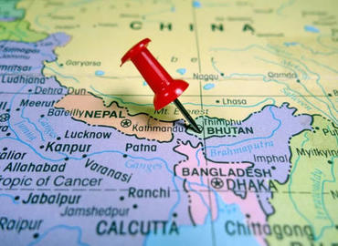
Himalayan Countries
- Zoe
- Last Updated : 09/23/2024
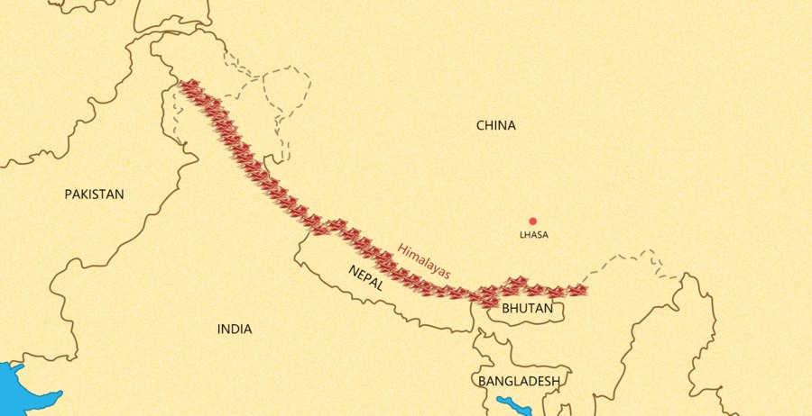
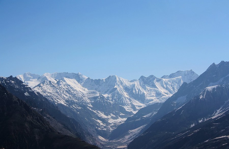
The Himalayas (Sanskrit: हिमालय) means "abode of snow" in the Tibetan. The Himalayas are the highest and most majestic mountain range in the world, as well as the natural boundary of the Tibetan Plateau and the Indian subcontinent, stretching continuously for 2,500 kilometers from west to east, between China(Tibet), India, Nepal, Bhutan, Pakistan and other countries. The mountain ranges do not belong to any single country, although Tibet, Nepal and Bhutan have sovereignty over most of the Himalayas, also Pakistan and India occupy part of it. The main part of the Himalayas stands at the junction of China and Nepal, including its main peak Mt.Everest(8,848m) - the highest peak in the world.
The northernmost section of the Himalayas is located in Pakistan, Kashmir, and Ladakh, followed by a large section of the northern foothills in the middle of Tibet, and the southern foothills are located in India, Nepal, Sikkim, and Bhutan. According to the map, neighboring Asian countries in the southern Himalayas from west to east are Afghanistan, Pakistan, India, Nepal, Bhutan, and Myanmar; while in the northern Himalayas, there's only one county - China.
The Himalayas mainly stand in five countries, namely, China(Tibet), Nepal, Bhutan, India and Pakistan.
Himalayas in Tibet
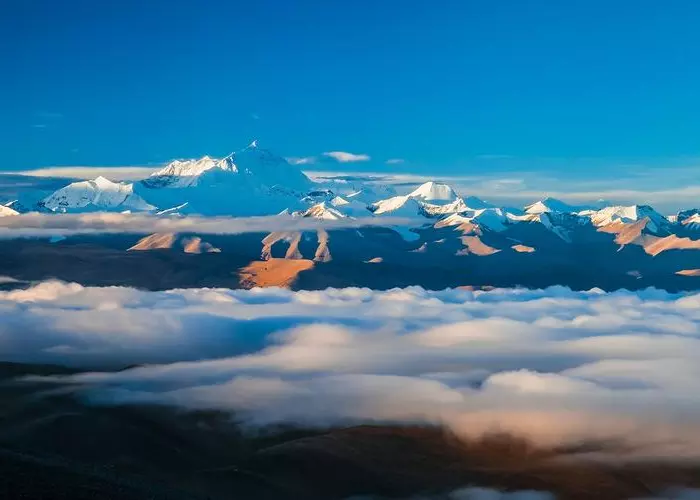
The Himalayas start in Tibet from Nanga Parbat in the northwestern part of the Tibetan Plateau in the west to Namcha Barwa at the sharp bend of the Yarlung Zangbo River in the east, with a total length of 2,450 kilometers and a width of 200-350 kilometers. The southern part of Tibet falls within the Himalayan region. Some of the highest mountains in the world define the southern border of Tibet including Mount Everest (8,848 m)-the highest mountain in the world, which is now a popular tourist destination in Shigatse, Tibet.
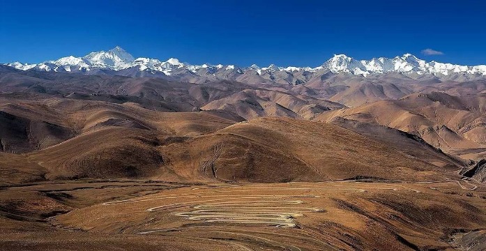
Best time to visit: spring (April–May) and autumn (September–October)
Viewing platform: Kya Wu Lha Pass, Rongbuk Monastery
Recommended travel duration: 8 -15 days
√ 8 Days Lhasa Gyantse Shigatse Mt. Everest Group Tour
Himalayas in Nepal
The Himalayas in Nepal start eastwards from the Kali River for about 500 miles (800 kilometers) to the Tista River. This area occupies most of Nepal and extends to the Tibet Autonomous Region of China and Sikkim State of India. Nepal Himalayas, the eastern-central section and highest part of the Himalayan mountain range in south-central Asia. Nepal-Tibet border roughly follows along the line of the highest parts of the Himalayas including Mount Everest (8,848m), Kangchenjunga (8,586m), Makalu (8,485m), Dhaulagiri I(8,617m), Manaslu I (8,163m), and Annapurna I(8,091m). Nepal is also one of the best destinations to experience the magnificent scenery of the Himalayas and there're a variety of trekking routes in the Himalayas of Nepal.
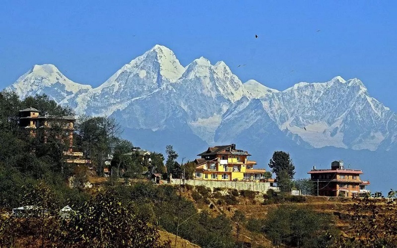
Best time to visit: September or October
Viewing platform: Nagarkot, Manakamana Temple, Gorkha
Recommended travel duration: 4-16 days
√ 4 Days Glimpse of Nepal Tour
√ 11 Days Annapurna Base Camp Trek
√ 16 Days Annapurna Circuit Trek
Himalayas in Bhutan
Located in the deep valleys of the eastern Himalayas, Bhutan this landlocked country borders China to the north and India to the south. Towering Himalayas dominate the northern part of the country, where the peaks can easily reach an elevation of 7,000 meters (22,966 feet), while the south part is relatively lower, with huge undulations. Due to the uplift of the Himalayas, there's abundant topographic rain and abundant forest coverage, about 72%. Trekking in Bhutan to discover the magnificent beauty of the mountains, no matter what to see, which villages to pass by, or whoever to meet, your travel experience will be unparalleled.
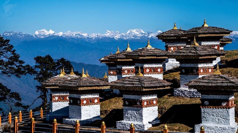
Best time to visit: October to December
Viewing platform: Dochula Pass
Recommended duration: 6-8 days
Himalayas in India
The Himalayas stand in the north of India. This mountain range forms the northern border of the Indian subcontinent and an almost insurmountable barrier between it and the northern continent. Within India the Himalayas are divided into three longitudinal belts, called the Outer, Lesser, and Great Himalayas. At each extremity, there is a great bend in the system’s alignment, from which a number of lower mountain ranges and hills spread out.
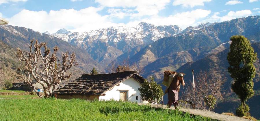
Best time to visit: October to November
Best viewing platform: Khali Estate, Saryu and Pindar Valleys
Himalayas in Pakistan
The Himalayas stand in the northwest of Pakistan, which is always been a physical and cultural gap between South Asia and Central Asia. Their western mountain ranges occupy the entire northern end of Pakistan, forming the north barrier of the subcontinent and extending about 320 kilometers into the country. The western Himalaya ranges spread over Kashmir and northern Pakistan, divided into three different mountain ranges, from south to north, namely the Pir Panjal Range, the Zaskar Range, and the Ladakh Range.
Email response within 0.5~24 hours.