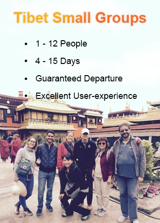
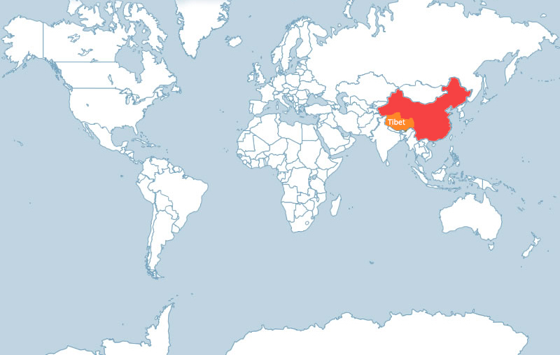
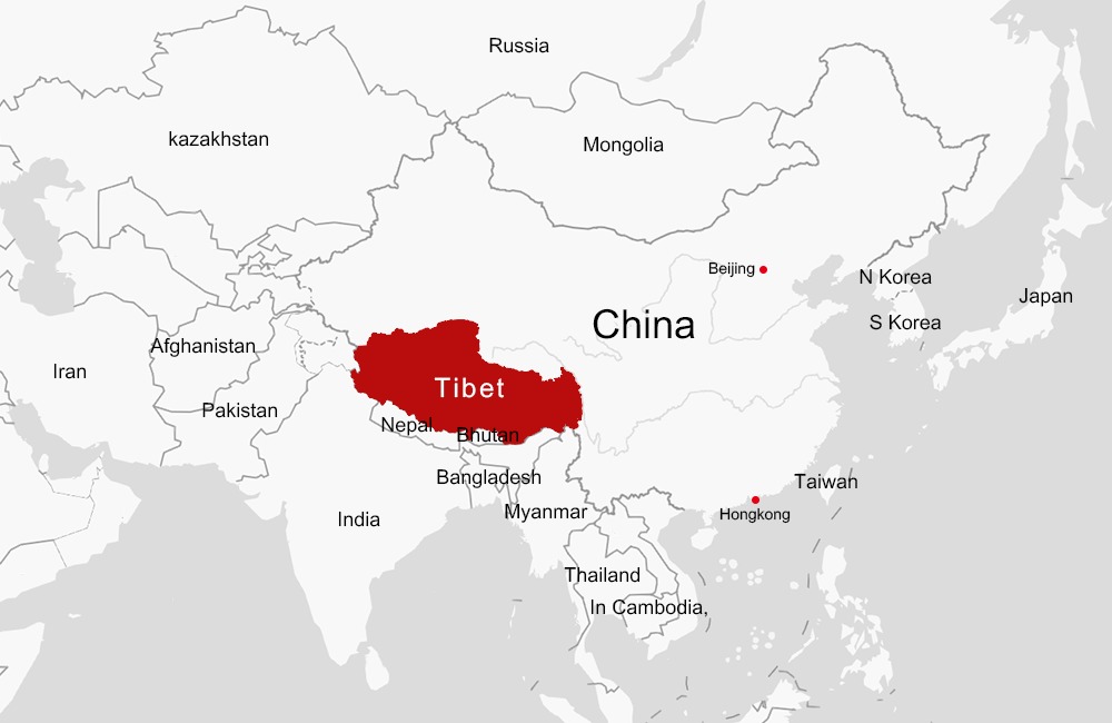
Where is Tibet?
- Eric
- Last Updated : 12/06/2024
Tibet Autonomous Region, located in the southwest of China with a land area of 1.22 million square kilometers, is the second-largest province in China. As one of the 5 Ethnic Minority Autonomous regions in China, Tibet borders the Xinjiang Uygur Autonomous Region and Qinghai Province to the north, Sichuan and Yunnan to the east, India, Nepal, Sikkim, and Burma to the south, and this borderline is about 4,000 kilometers. Lying on the Qinghai-Tibet Plateau with an average altitude of 4,000 meters, Tibet is the highest region in the world and is called “the roof of the world”.
Tibet is an inalienable part of Chinese territory. Since the Yuan Dynasty, the government had jurisdiction over Tibet. The Chinese government had direct control over Tibet since 1965. Nowadays, the economy of Tibet and the living standards of Tibet are promoted largely with the help of the Chinese government.
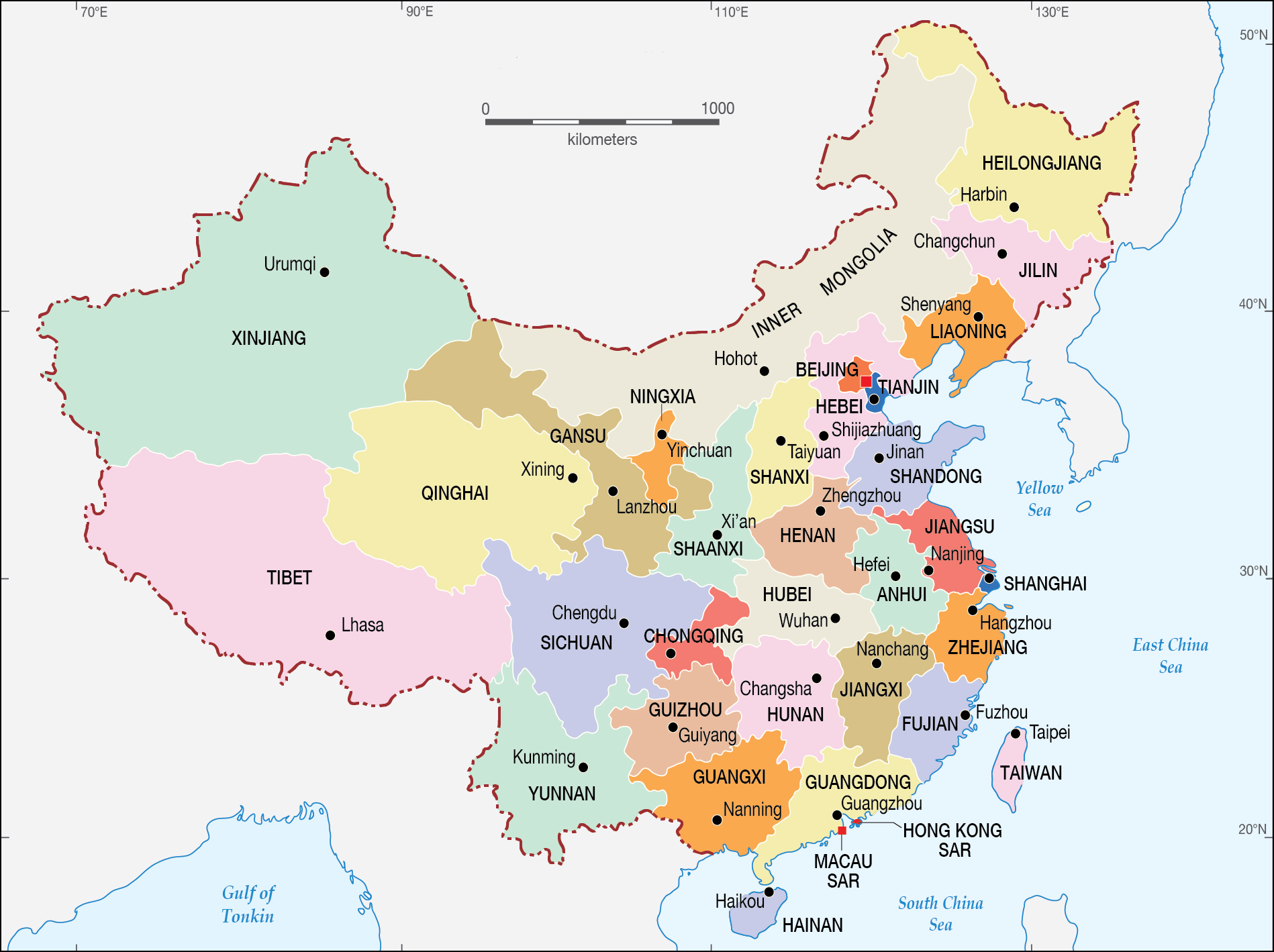
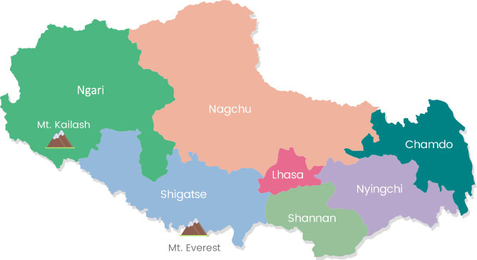
Administrative Map of Tibet
Tibet is a large region with a capital city, six prefectures, 72 counties, and has about 3.3 million people. The capital city of Tibet is Lhasa (3658m), and six prefectures are Shigatse, Ngari, Shannan, Nagqu, Nyingchi, and Chamdo. The highest prefecture is Ngari (4500m), the lowest prefecture is Nyingchi ( 3000m), and the world’s highest mountain is Mt. Everest (8848m) in Shigatse prefecture.
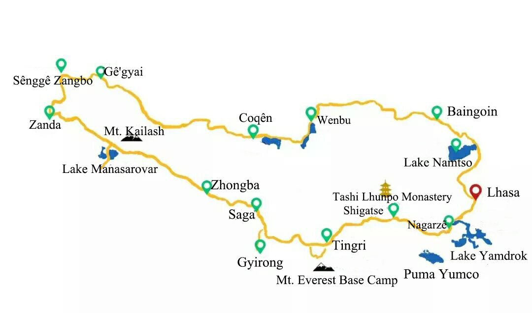
Tibet Travel Map
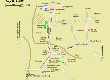
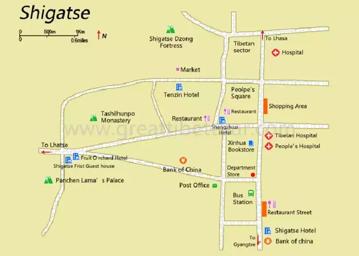
Tibet is the second largest region in China with a great number of attractions, so the travel map of Tibet is essential for tourists to know about where the most famous scenic spots are. And due to the unique features of Tibetan geography, culture, customs, and history, tourists can enjoy different kinds of Buddhist monasteries in different prefectures, explore holy lakes and sacred mountains with ancient legends, just Mount Everest, Lake Namtso, Tashi Lhunpo Monastery, Mount Kailash, etc.
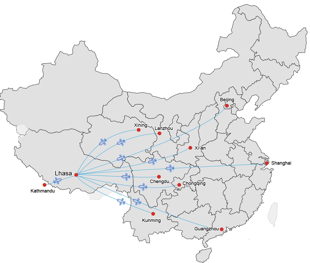
Tibet Transportation
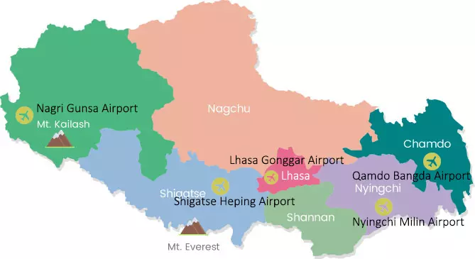
There are three means of transportation in and out of Tibet: air, railway, and road. Lhasa is the transportation hub of the whole Tibet. Inside Tibet, the main mode of transportation is highway traffic and cars are the major means of transportation.
Air: At present, there are 5 airports in Tibet- Gonggar Airport in Lhasa, Mailing Airport in Nyingchi, Peace Airport in Shigatse, Bangda Airport in Qamdo, and Gunsa Airport in Ngari. Most travelers would fly to Lhasa.
Highway: The friendship highway runs from Tibet to Nepal. It starts from Lhasa, passes through Shigatse, Lhatse county (318 national highway), and then is divided into two branch lines (mainly the eastern line). The eastern route is "Tingri - Nyalam highway": Tingri - Nyalam county - Zhangmu port - friendship bridge - Nepal's capital Kathmandu. This route is 943 kilometers long and 829 kilometers within Tibet. It opened to traffic in 1965. The western route is "Lhatse county –Gyirong highway": Lhatse - 219 national road – Gyirong country - Gyirong port - Nepal.
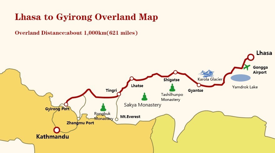 Lhasa to Gyirong Overland Map.
Qinghai-Tibet railway: The Qinghai-Tibet railway is a connection railway between Xining city in Qinghai province to Lhasa in Tibet autonomous region. It is the first railway to Tibet's hinterland and the world's highest and longest plateau railway line. You can enjoy the beautiful scenery along the Qinghai-Tibet railway.
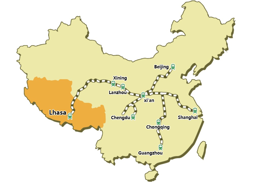
Lines of Qinghai-Tibet Railway.
Tibet Trekking Map
In addition to the mountainous terrain, there are many glacial lakes, valleys and other amazing landscapes in Tibet. With this awesome terrain, Tibet is considered to have the best hiking trails in the world.
The top 3 trekking routes are Mt.Kailash Trek, Ganden to Samye Trek and old Tingri to EBC Trek. For the easy trekking routes, Ganden to Samye trek and Tsurphu to Yangpachen trek are the best choices; for the picturesque hiking trail, Nyenchen Tanglha to Holy Lake-Namtso is highly recommended; for the challenging hiking route, old Tingri to EBC and Mt.Kailash trek should be considered.

Mt.Kailash trekking map

Old Tingri to EBC trekking map

Ganden to Samye trekking map

Tsurphu to Yangpachen trekking map
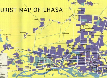
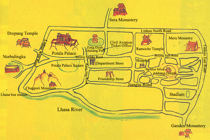
Lhasa Attractions Map
The detailed Lhasa attraction map can help you tour Tibet much more easily so that you can efficiently find the hospital, hotel, bus station, departments, banks, scenic spots and other locations you need to go along the road on the map. Lhasa is the capital city of Tibet with profound history, culture, and stunning attractions. Therefore, you can explore Lhasa with these highlights on the map, like Potala Palace, Jokhang Temple, Sera Monastery, Deprung Monastery, Barkhor Street, Norbulingka, etc.
>> Read more about Lhasa Travel Map
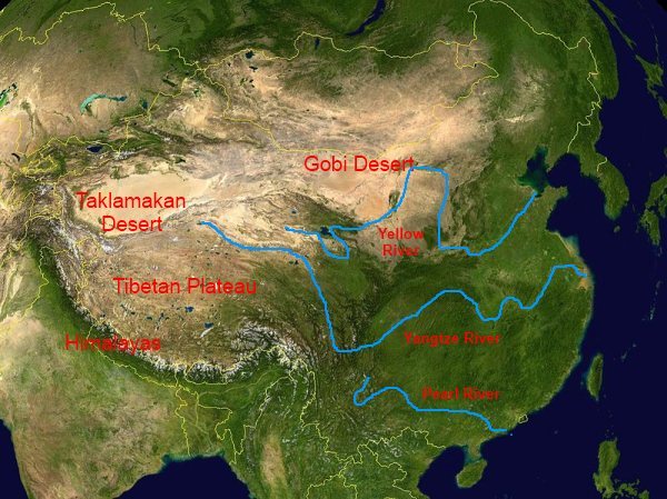
Tibet Topographical Map
The Qinghai-Tibet Plateau is the largest and highest plateau in the world. The Plateau of Tibet is located in the main area of the Qinghai-Tibet Plateau. It's known as the “roof of the world” and the “third pole of the earth". The terrain is generally inclined from northwest to southwest and the topography is complex and various with steep and meandering mountains and canyons. The landform can be divided into three regions, including the Himalayas, southern Tibetan valley, northern Tibetan plateau and alpine canyon area of eastern Tibet. Meanwhile, the landform can be divided into six types: extremely high mountains, high mountains, mountains, low mountains, hills and plains, as well as ice margins, karst landforms, aeolian landforms, and volcanic landforms.
Major Rivers Resourced in Tibet
Qinghai-Tibet plateau resourced many rivers. It includes the Yarlung Zangbo River, Nujiang, Pum Chu River, Yangtze River, Yellow River and Lancang River in China. Moreover, the headwaters of some major rivers in Asia also originated from the Tibetan Plateau, including the Indus, Ganges, Brahmaputra, Irrawaddy, Salween and Mekong rivers.
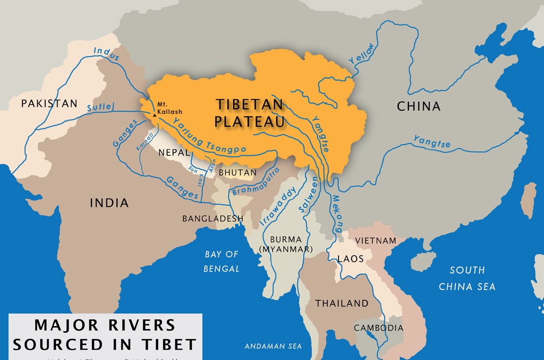 Major rivers resourced in Tibet.
Email response within 0.5~24 hours.