
Tibet Map
Maps play an important role in your Tibet travel. Search for the most recent Tibet maps? Here we provide easy-understanding maps to help you get a better understanding of Tibet's geography, administrative division, tourist attractions, cities, transportation, etc. You also can check the detailed map of Tibet. All these maps are printable. Please feel free to use them when visiting Tibet.
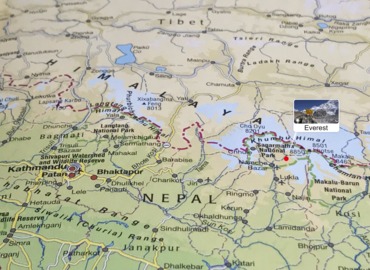
Tibet Location Map
Tibet Autonomous Region is located in the southwestern border of the People’s Republic of China and the southwestern part of the Qinghai-Tibet Plateau, with an average altitude of more than 4000 meters. It is known as the “roof of the world“. In China, Tibet borders Xinjiang in the north, Sichuan in the east, Qinghai in the northeast, and Yunnan in the southeast. Outside of China, it's bordered by countries and regions such as Myanmar, India, Bhutan, Nepal, and Kashmir, and has a land border of more than 4,000 kilometers. Tibet is an important gateway to the southwestern border of China. >> See more about the Location of Tibet

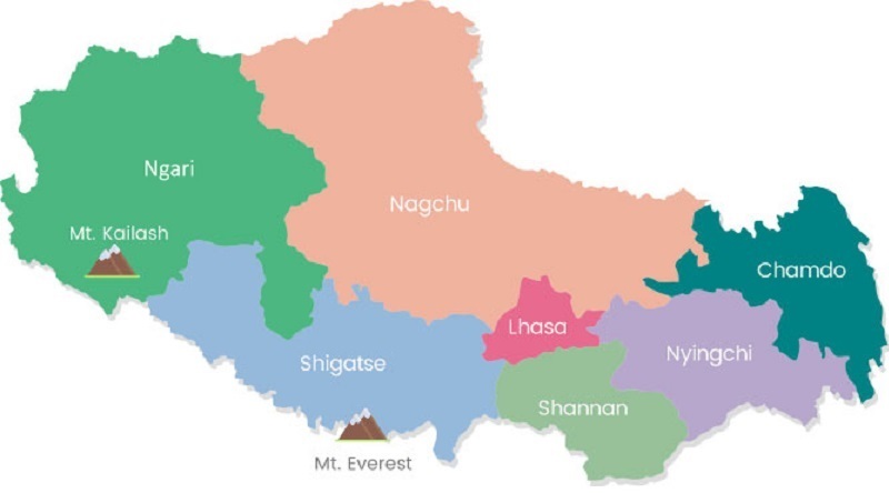
Tibet Political Map
Tibet is a large region with a capital city, six prefectures, 72 counties, and has about 3.3 million people. The capital city of Tibet is Lhasa (3658m), and six prefectures are Shigatse, Ngari, Shannan, Nagqu, Nyingchi, and Chamdo. The highest prefecture is Ngari (4500m), the lowest prefecture is Nyingchi ( 3000m), and the world’s highest mountain is Mt. Everest (8844.43m) in Shigatse prefecture.
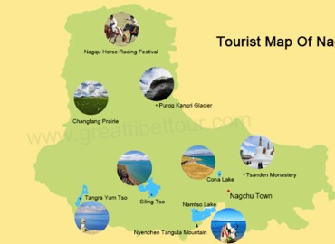
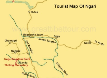
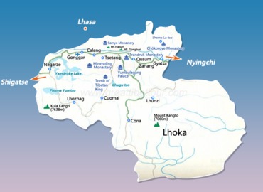
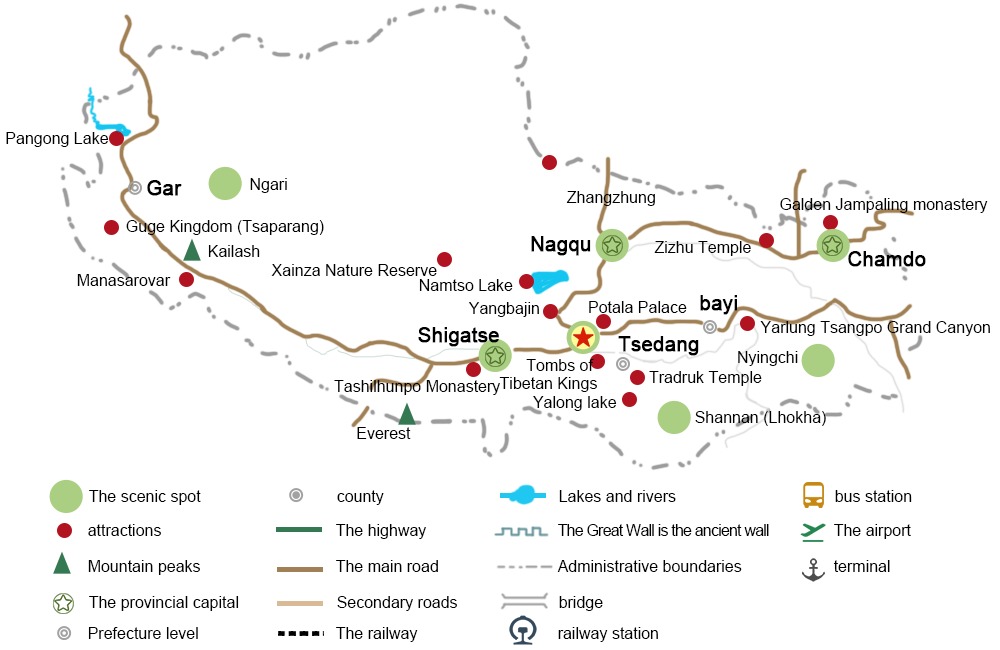
Tibet Tourist Maps
Tibet is vast and there're numerous places of interest deserving your visits. You must have known the most popular tourist attractions first, while you may not know where they located. Have a look at the tourist maps below to learn the exact locations of the attractions.

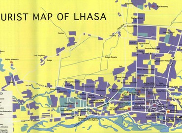
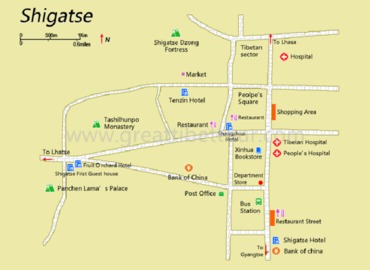
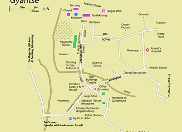
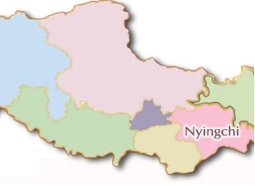
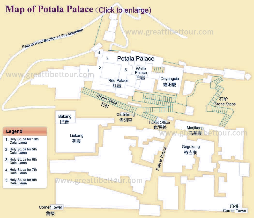
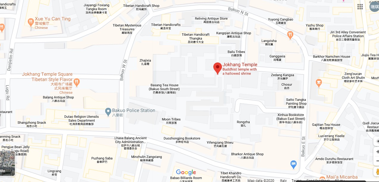
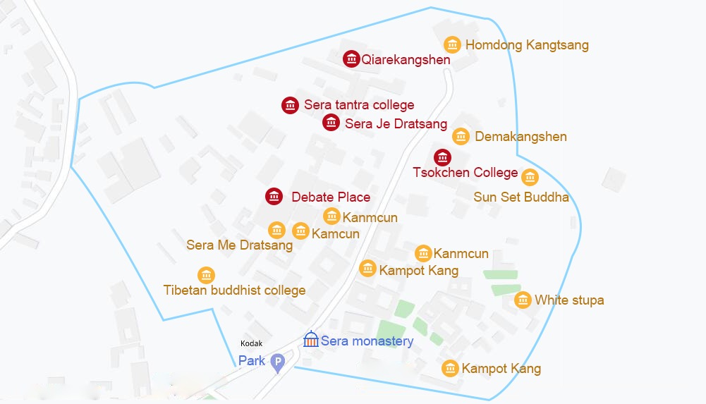
Tibet Prefecture/City Maps
There are maps in each of the hot tourist prefectures/cities in Tibet. They will show you the details of each place. Just click the images below.
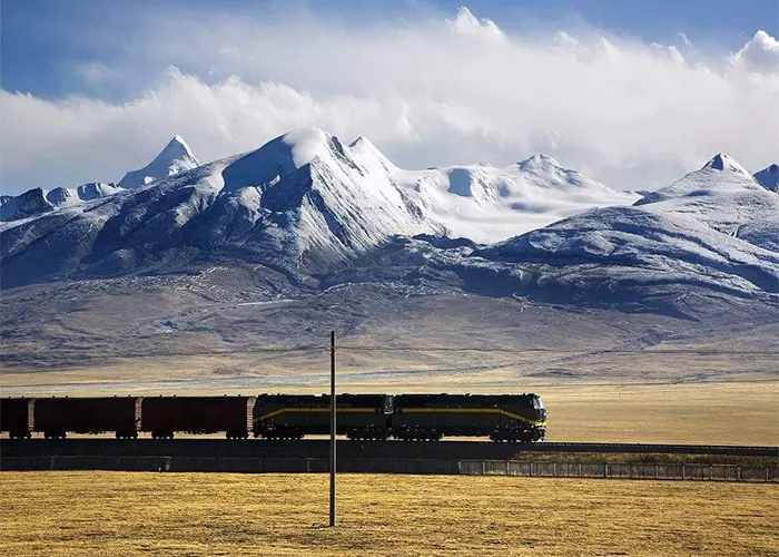
Tibet Railway Map
Most travelers still choose to take a train to Tibet, which is not only an economical, safe, and comfortable way to access Tibet but also a great way to enjoy the scenery along the Qinghai-Tibet Railway. Only a few trains can reach Tibet directly as below,

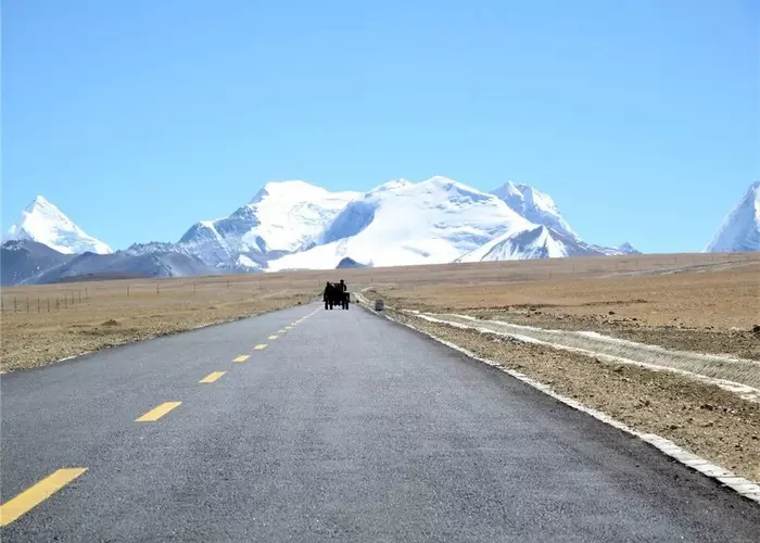
Tibet Road Map
Lhasa is the transportation hub of Tibet. The traffic in Tibet is mainly highways, and cars are the main means of transportation. Here's a tourist road map covering most of the scenic spots.
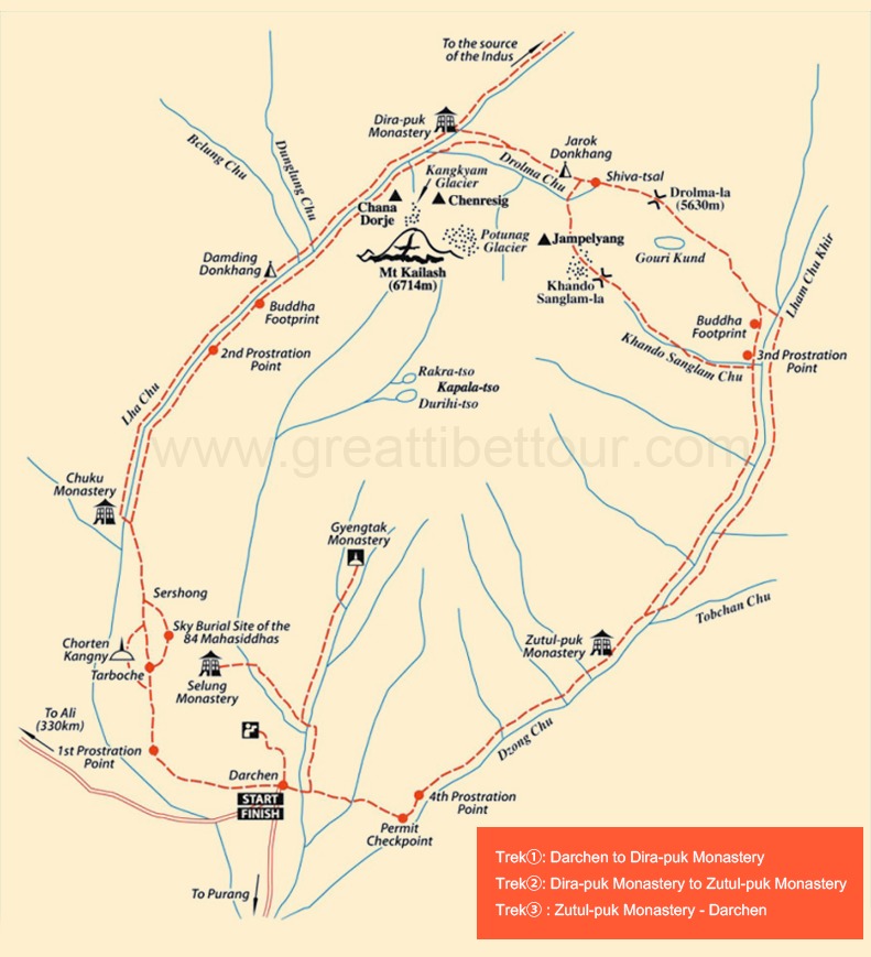
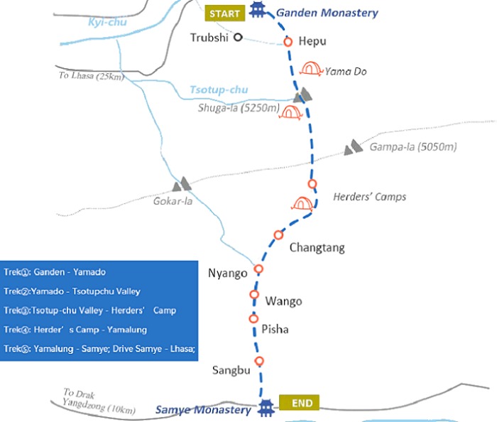
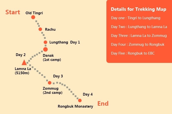
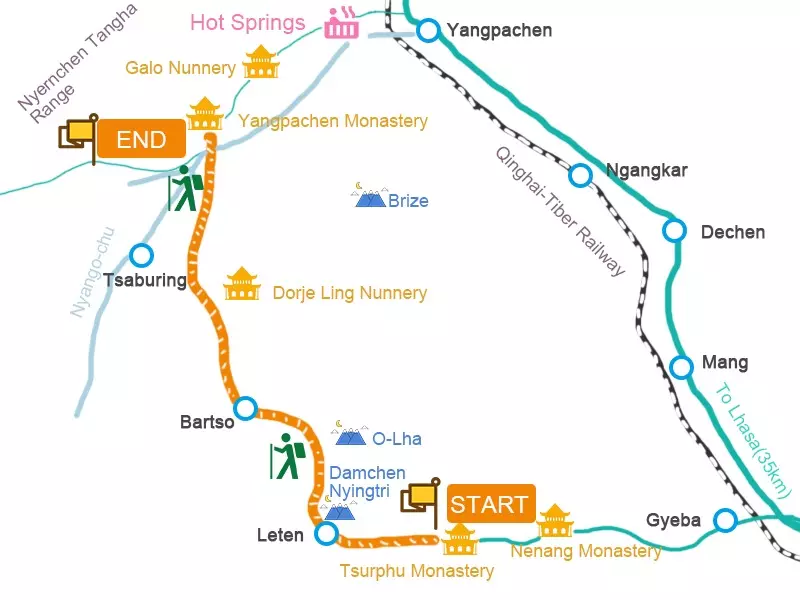
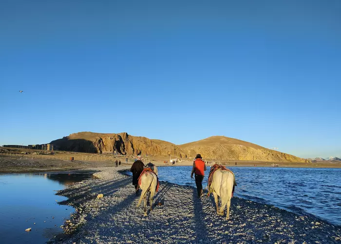
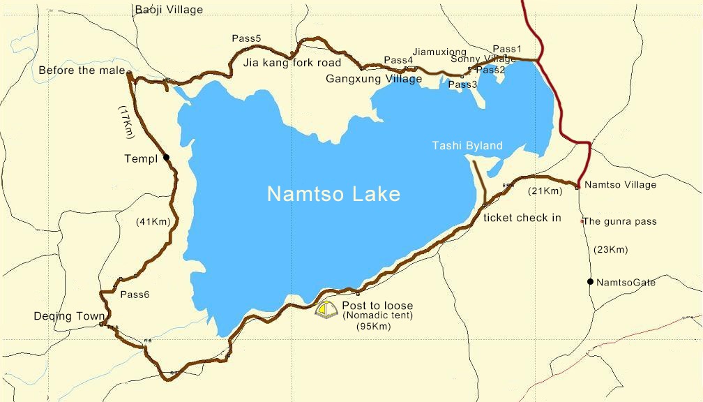
Tibet Trekking Maps
There're uncountable trekking routes in Tibet with natural scenery, cultural landscapes, and religious beliefs. Hiking in Tibet is like a gift of direct dialogue with the creator, from which you can see ancient creatures, totems, and worship. Here're the most popular trek maps for you.