Where is Bhutan on Map
- Eric
- Last Updated : 07/31/2026
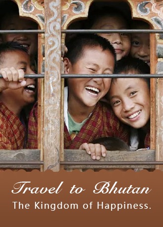
Bhutan is often regarded as one of the world's happiest countries. Located in southern Asia, Bhutan is a landlocked country on the southern slopes of the eastern Himalayas. With a population of around 800,000, Bhutan is one of the world's least-populated countries. Dzongkha is the official language, while English is widely used in education, government, and tourism. Tibetan Buddhism (Drukpa Kagyu) is the state religion. The currency is ngultrum. The capital, Thimphu, is the political and religious center of the country. In Sanskrit, the Kingdom of Bhutan means "the border of Tibet". Bhutan is also known as the Kingdom of the Dragon.
For this unique and mysterious country, since it has little contact with the world, tourists know less about Bhutan. To help you make the most of your Bhutan travel and better understand your expected Shangri-La, we have collected and sorted out various kinds of Bhutan maps, including where's Bhutan, political map, tourist map, transportation map, trekking map, etc.
Where Is Bhutan On a Map
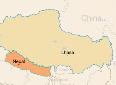
Bhutan is a mountain country located at the southern foot of the Himalayas between India and Tibet. The average altitude is over 3000 meters. It borders Tibet in the northwest and north, India in the west, Bangladesh in the south, and Tibet's Lhoka in the east, with a total area of 38,394 square kilometers.


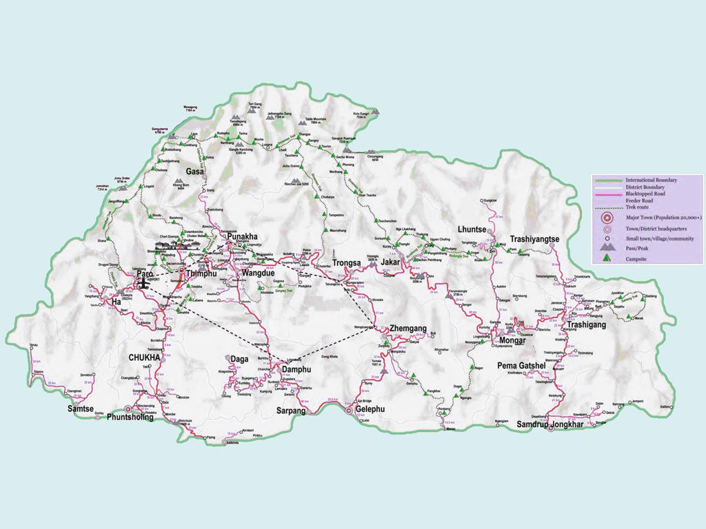
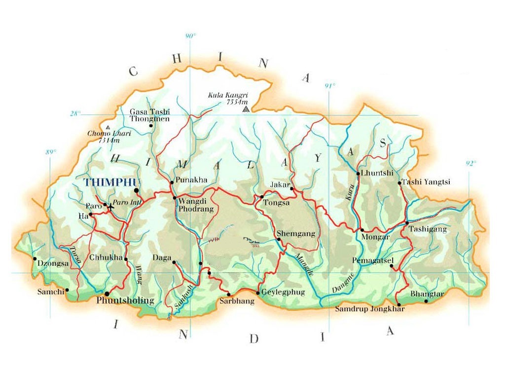
Political Map of Bhutan
Bhutan is administratively divided into 4 regions, 20 administrative regions(counties), and more than 4,500 villages. The capital city of Bhutan is Thimphu, located in the Wang Chu River Valley, with an altitude of 2500 meters. Thimphu is also the largest city in the country.


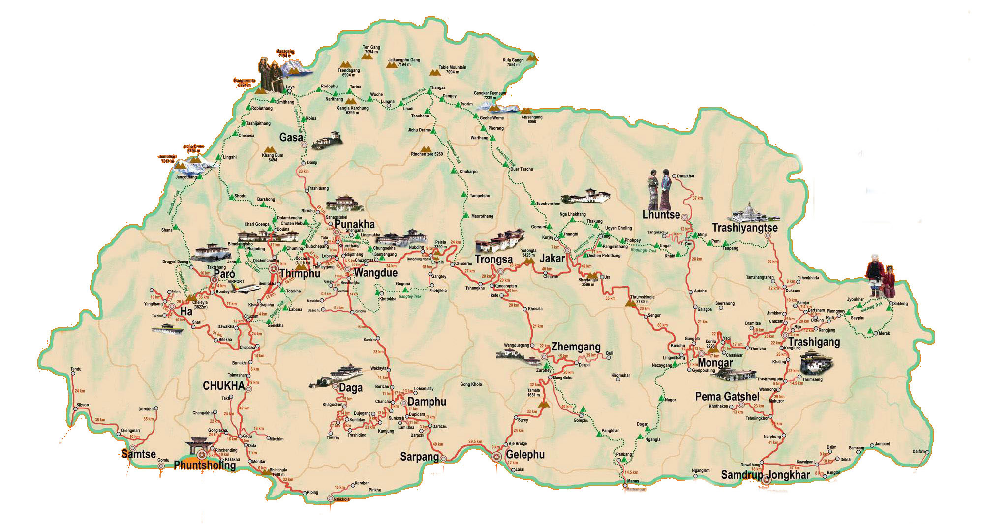
Bhutan Tourist Maps
Bhutan's tourist attractions are mainly concentrated in the western regions, such as Paro, Thimphu and Punakha. Heading toward central Bhutan, travelers can explore the scenic valleys of Phobjikha, Trongsa, and Bumthang, where ancient monasteries and historic dzongs are scattered among the hills and valleys

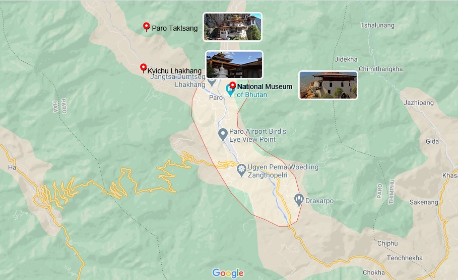
1. Paro
Paro is the gateway to Bhutan. It's located in the fertile and beautiful Paro River Valley. It was once the political center of Western Bhutan. The most famous attraction in Paro is Taktshang Monastery, which is also the landmark of Bhutan. Paro Dzong (Rinpung Dzong) is the first Dzong sighted by tourists after getting off the plane. This magnificent Dzong is a great example of Bhutanese architecture.
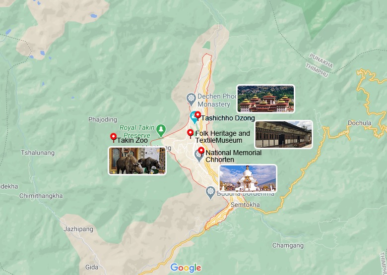
2. Thimphu
The most worth visiting attraction in Thimphu is undoubtedly Tashichho Dzong. The Dzongs distributed in the major cities of Bhutan are the seats of the government, and Tashichho Dzong is equivalent to the central government of Bhutan. Bhutan is a famous stamp country in the world. You can customize your own portrait stamps-this is the best souvenir that most travelers will not want to miss. At the same time, you can visit the famous handmade goods market. In addition, Tarkin is a major attraction as a national animal.
3. Punakha
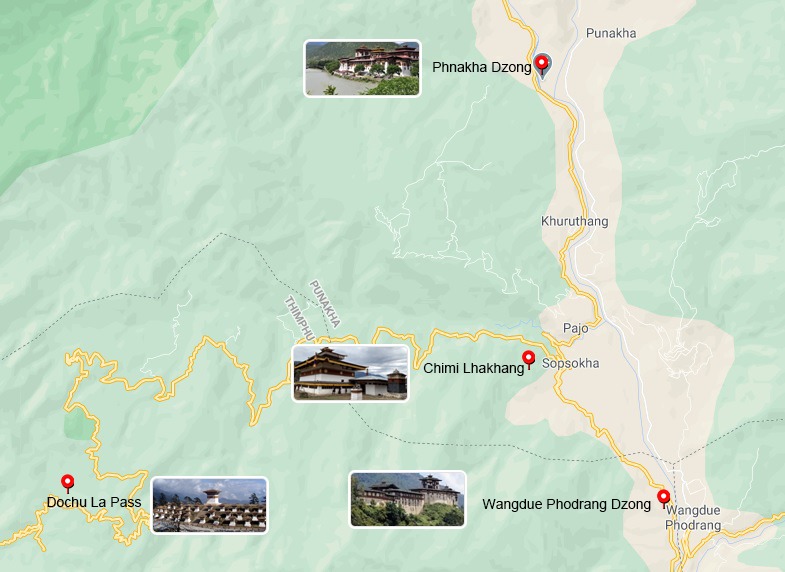
By crossing over the Dochu La Pass, where you can see 108 pagodas standing on the inner side of the mountain and towering sacred snow peaks of the Himalayas, you will get to Punakha. It was once the capital of ancient Bhutan and the winter residence of nobles. Punakha Dzong is the most beautiful fortress in Bhutan. It looks splendid all year round, especially in the spring when Jacarandas bloom luxuriantly.
4. Phobjikha
There are not only elegant black-necked cranes in the valley. The superior ecological environment also attracts many rare birds, large mammals, and diverse plant resources unique to the Himalayas, as well as ecotourists who are attracted by these animals and plants.
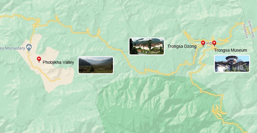
5. Trongsa
The journey to Trongsa is the most winding section of the entire Bhutan travel routes, with unlimited scenery constantly appearing above the dangerous peaks. Trongsa Dzong was built on a small platform in the mountain cols. Below the Dzong is a cliff of hundreds of meters. Surrounding it, the entire town of Trongsa is spread out on steep hillsides. Trongsa Dzong is the largest architectural complex in Bhutan.
6. Bumthang
Bumthang Valley is the birthplace of Bhutan's culture and Buddhism. Not only does it have beautiful landscapes and many ancient temples, but also rich local products and specialties, which should not be missed. The entire Bumthang Valley is very suitable for outdoor cross-country sports, and there are many classic hiking routes.
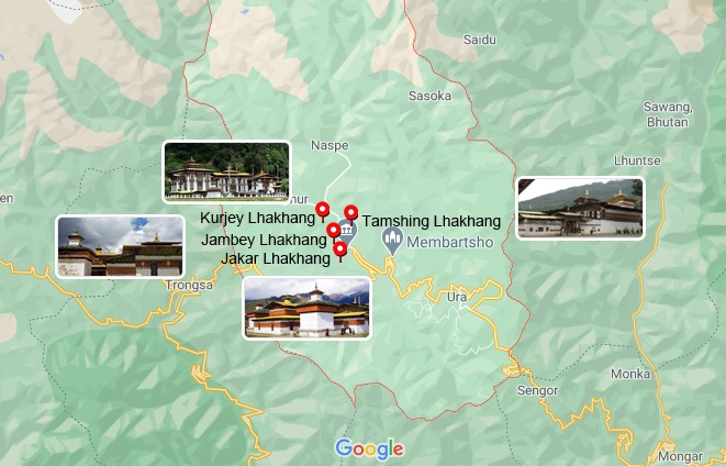 Bumthang tourist map with attractions
Transportation Map of Bhutan
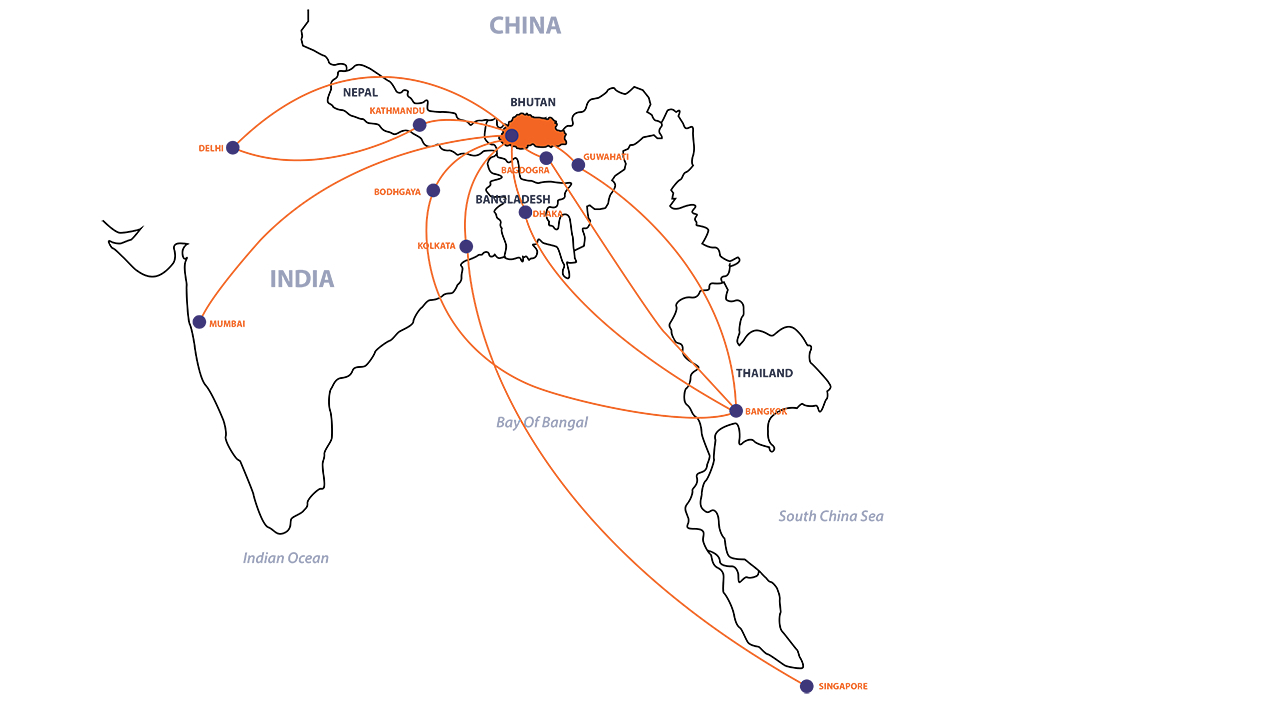
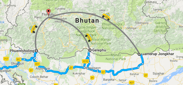
The best way to travel to Bhutan is by plane. Currently, only Kathmandu in Nepal, New Delhi and Kolkata in India, Dhaka in Bangladesh, Yangon in Myanmar and Bangkok in Thailand have opened direct flights to Bhutan. In addition, it is possible to enter Bhutan from India by land, but the land way is too hard, takes a long time, and the visa is very troublesome.
Currently, the only flights in and out of Bhutan are Royal Bhutan Airlines, and other airlines are not allowed to fly Bhutan routes. Although Bhutan Airlines is a monopoly, objectively speaking, the safety and service levels of the aircraft are still good. Therefore, to travel to Bhutan, the best mode of transportation is by plane, and you can only take the flight of Royal Bhutan Airlines.
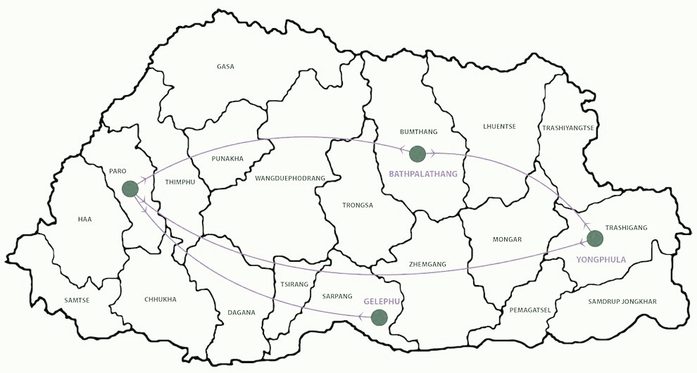
There are no civil aviation and helicopter transportation services in Bhutan, and there is no railway. Therefore, the means of transportation are mainly cars and walking. All major towns in the 20 districts of Bhutan can be reached by road. The characteristic of road travel in Bhutan is that the road surface is very bumpy, which makes the driving speed slower than normal, rarely exceeding 40 km/h. General cars are provided by travel agencies, and self-service tourists can find public transportation services. But public transportation is relatively small and often crowded. Although taxis can be found in major tourist cities and regions, it should be noted that many taxis are not supervised and are prone to problems.
Trekking Map of Bhutan
Bhutan is called The Last Shangri-La. It's a mountainous area full of traditions. For a long time, Bhutan has been isolated from the world, retaining its original environment and unique culture. Surrounded by snow-covered mountains, emerald-green rice fields, and crystal streams, this kingdom is located in the vast Himalayas. Bhutan's fascinating landscape and unique natural conditions are a paradise for hikers from all over the world, and there are many kinds of trekking routes. There are not only three-day short-term treks in low-altitude areas but also a three-week trekking trip of 356 kilometers and climbing the highest mountain pass in Bhutan. Snowman Trek is the most famous Bhutan trekking route, which is one of the most challenging trekking routes in the world because of its high altitude and long route. The number of people completing this trekking route is much smaller than that of Mount Everest.
For most tourists, the most popular and best trekking route is the Bhutan Thunder Dragon Trail. This is a footpath connecting Paro and the Thimphu Valley, where you can appreciate the temples and amazing mountain scenery along the way.
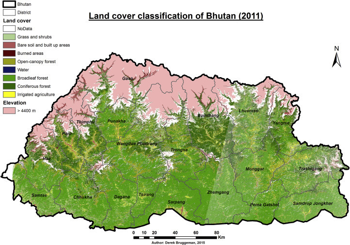
Geography Map of Bhutan
The terrain of Bhutan is very different. The north is high and the south is low. From north to south, it gradually decreases. It is divided into three parts - northern alpine region, mid-valley area and southern hills and plains. Except for a fraction of the Duars Plain in the south, the mountainous area accounts for 94% in Bhutan. Bhutan, known as a country of mountains, has huge altitude differences across regions. One is the Manas Chhu, the lowest elevation in the country, located in the southeast. Its altitude is only 97 meters. The other is the northern Himalayas, where the peaks are above 6000 to 7000 meters above sea level. In particular, Kula Kangri has an altitude of 7554 meters, which is the highest peak in Bhutan. Bhutan glaciers are mainly located in the high mountains of northern Bhutan, accounting for 10% of the total area of Bhutan. These glaciers are the source of important renewable water resources in the rivers of Bhutan. They can bring a lot of fresh water to the people of Bhutan every year.
Flag of the Kingdom of Bhutan
The Bhutanese have always been very fond of the dragon because they think that it is one of four spirit animals of ancient. The auspicious animal is supposed to be in charge of the weather, so the wind and rain come at their time. Bhutan sits in the foothills of the Himalayas and has a lot of time for thunder. Bhutanese believe that thunder comes from the screaming of a dragon, which is powerful. As a result, the Bhutanese call their country the Land of the Thunder Dragon and take the dragon as the main pattern of their national flag.

Email response within 0.5~24 hours.