Tibetan Plateau - The World's Highest Plateau
- Catherine
- Last Updated : 05/27/2025
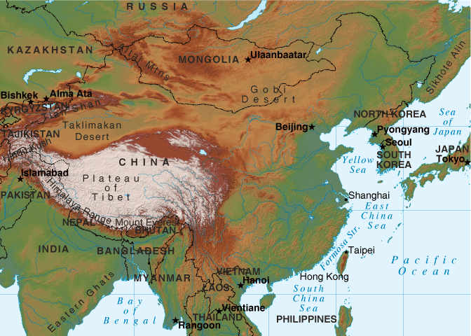
Tibet Plateau or Qinghai-Tibet Plateau is the world's highest plateau, with an altitude of more than 4,000 meters, known as the "roof of the world". Actually Tibet Plateau and Qinghai-Tibet Plateau are different geographical concepts. The concept of the Tibetan Plateau in China refers only to a part of the Qinghai-Tibet Plateau, whose range refers to the area south of the Kunlun Mountains, north of the Himalayas, east of the Karakorum Mountains, and west of the Hengduan Mountains. After the mid-20th century, the term "Qinghai-Tibet Plateau" was widely used in China. However, in foreign countries, the term "Tibetan Plateau" was adopted to describe the whole Qinghai-Tibet Plateau, which had been used since the beginning of the 20th century. The scientific research community in China has adopted the Tibetan Plateau to translate "Qinghai-Tibet Plateau". So, the Tibetan Plateau mentioned below will be stated in a broad concept as the Qinghai-Tibet Plateau.
Facts About The Plateau of Tibet
- Latitude: 25°-40° N
- Longitude: 74°-104° E
- Area: 965,300 mi²
- Length: 2,500 km (1,600 mi)
- Width: 1,000 km (620 mi)
- Average Altitude: 4,500m
- Country: China, Bhutan, Nepal, India, Pakistan, Afghanistan, Tajikistan, Kyrgyzstan
The Tibetan Plateau is the East Asian plateau region, the highest plateau in the world, known as the "Roof of the World", "Snowy Plateau" and "Third Pole". Most of the areas are located in the Tibet Autonomous Region and Qinghai Province in western China, and part of Indian-controlled Kashmir. In China, it includes Tibet Autonomous Region, Qinghai Province, Xinjiang Uygur Autonomous Region, Gansu Province, Sichuan Province, and Yunnan Province, accounting for 23% of the total area of China.
Six Geographical Regions
Geographically, the Plateau of Tibet can be divided into six parts: Northern Tibetan Plateau, Southern Tibetan Valley, Qaidam Basin, Qilian Mountain, Qinghai Plateau, and the Sichuan-Tibet Alpine Canyon Region.
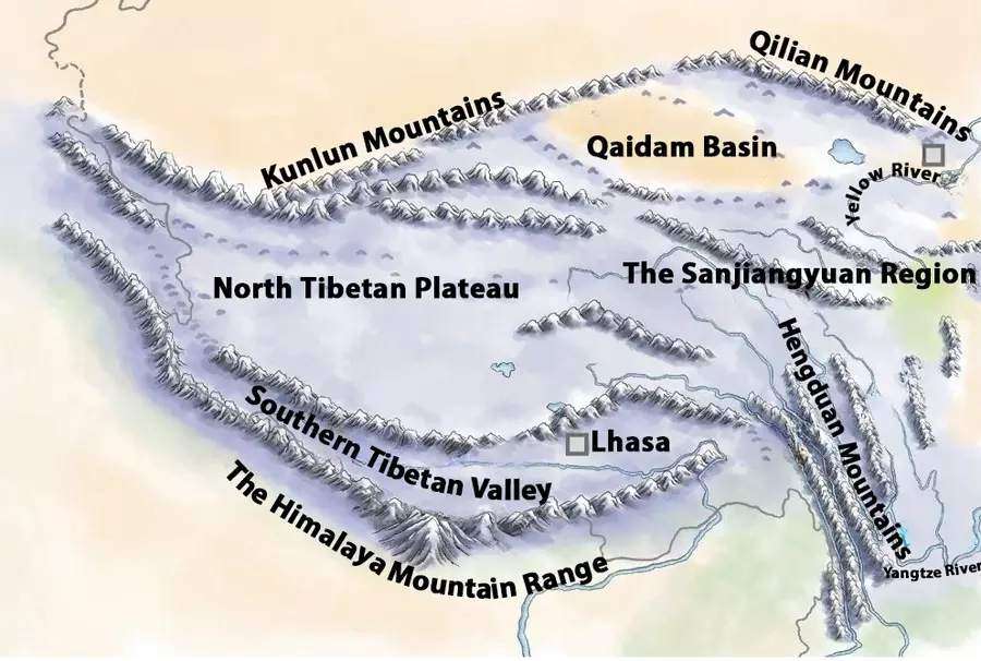
1. The Northern Tibetan Plateau is located in the northern part of the Tibet Autonomous Region, between the Gangdise Mountains, the Kunlun Mountains, and the Tanggula Mountains. The altitude is generally around 4,500 meters, which is the core part of the Qinghai-Tibet Plateau. The ground is not undulating, and there are a series of high-altitude mountain ranges, but they don't look relatively high due to the plateau background. Many peaks are covered with snow all year round and glaciers are widespread.
2. Southern Tibetan Valley also is known as the southern Tibet mountainous region. It's located in the south of Tibet Autonomous Region, upstream of the Yarlung Zangbo River, between the Himalayas and the Gangdise Mountains. It is about 1200 km long from east to west and 300 ~ 500km wide from north to south. The altitude is 3,000 ~ 4,000 meters. Along the bank of the river valley is mostly a partial plain.
3. Qaidam Basin is located between 90°16 '~ 99°10' east longitude and 35°20 '~ 39°25' north latitude, which is the largest plateau basin in Qinghai Province. It is 800 kilometers long from east to west and 400 kilometers wide from north to south, with a total area of about 270,000 square kilometers. It is under the jurisdiction of Haixi Mongolian and Tibetan Autonomous Prefecture of Qinghai Province.
4. Qilian Mountains are located in the northeast of Qinghai Province. They are adjacent to the Hexi Corridor of Gansu Province in the north and east and to the Qaidam Basin in the south. Qilian Mountains are composed of fault-block mountains and valleys. They are 1,200 kilometers long from east to west and 250~400 kilometers wide from north to south, covering an area of about 100,000 square kilometers. The inter-mountain basins and valleys are generally between 3,000 and 4,000 meters above sea level, among which there are many peaks above 5,000 meters. The western terrain is high, and the ridges and valleys are parallelly spaced.
5. Qinghai Plateau is in the northeast part of the Tibetan Plateau, from the Buerhan Buda Mountains and Qilian Mountains in the north to the northwest border of Sichuan in the south, to Xiqing Mountain in the east, and to Tanggula Mountains in the southwest. Qinghai Plateau's average altitude is 4,000 meters above sea level. The highest point is Bukadaban Peak in the Kunlun Mountains, with an altitude of 6,860 meters. The lowest point is Xiaguankou Village in Minhe County, with an altitude of 1,650 meters.
6. Sichuan-Tibet Alpine Canyon Region refers to the western Sichuan Province, eastern Tibet Autonomous Region, and northwest Yunnan Province. It is located in the southeast of the Tibetan Plateau. This region is featured by high-altitude and deep-cut landforms. Mountains and rivers are alternately located. From east to west, there are Jiuding Mountain, Minjiang River, Qionglai Mountain, Dadu River, Daxue Mountain, Yalong River, Sharuli Mountain, Jinsha River, Quiet Mountain, Lancang River, Nu Mountain, Nu River and so on, with an altitude ranging from 3,000 ~ 4,500 meters.
Diverse Landforms
Tibetan Plateau's landform is diverse. It has a complex natural environment and various topographic features. It can be basically divided into six types: extremely high mountains, big mountains, medium mountains, low mountains, hills, and plains. In addition, there are glacial landforms, karst landforms, aeolian landforms, volcanic landforms, etc., which are unique and diverse in physical shape.
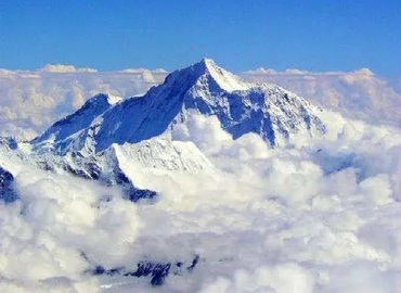
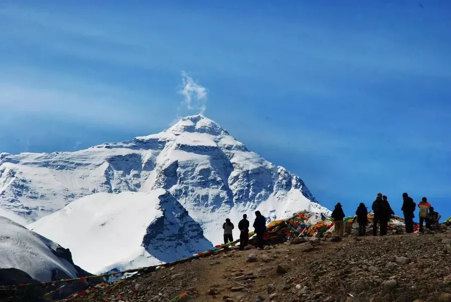
Mountain: The Plateau of Tibet is surrounded by many mountains, for example, the Kunlun Mountains, the Tangula Mountains, the Hengduan Mountains, the Gangdise Mountains, the Nyenqing Tangula Mountains, and the Himalayas, most of which run from northwest to southeast. They rise steeply from sea level. Among them, many peaks in the southern Himalayas are ranked in the top ten in the world. In particular, Everest is the highest peak in the world.
Glacier: Glaciers on the Tibetan Plateau cover an area of 47,000 square kilometers, like Himalayan glaciers, Nyenqing Tanggula Mountain glaciers, Kunlun Mountain glaciers, etc., accounting for more than 80 percent of China's total area of glaciers.
River: The distribution of rivers in the Qinghai-Tibet Plateau is mainly affected by the climate and its own topography. In addition to the abundant rainfall in the southeast, the river supply in the inland area mainly depends on the melting of glaciers or snow. The Qinghai-Tibet Plateau is the birthplace of many rivers in China, with dense river networks in the southern and eastern margins. The larger outflow rivers are the Yarlung Zangbo River (the major tributaries include the Lhasa River, Nianchu River, Nyang Qu and Palonzangbu, etc.), Nu River, Pengqu and India River belonging to the Indian water system, as well as the upper reaches of major rivers such as the Yangtze, Yellow and Lancang Rivers belonging to the Pacific water system.
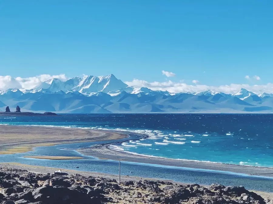
Lake: Tibet Plateau has not only raised most of the major rivers in Asia but also a series of salt lakes and freshwater lakes. There are more than 1,500 lakes in the Tibetan Plateau lake area. The lakes in this area are mainly saltwater lakes and salt lakes. The famous lakes include Namtso, Qinghai Lake, Qarhan Salt Lake and Eling Lake. Due to the differences in the depths, sediments, and microscopic organisms of different lakes, when viewed from above, they collectively appear countless green, blue, and turquoise. The surface area and shape of the lakes vary greatly. The biggest lake is Silingtso while the most famous one is Namtso, which ranks among the highest salt lakes in the world, with an altitude of 4,718 meters. It is about 25 kilometers long and 79 kilometers wide.
Climate Characteristics of the Tibetan Plateau
The climate features strong radiation, abundant sunshine, and less accumulated temperature, and the temperature decreases with the increase in altitude and latitude. According to calculations, the average annual temperature decreases by 0.57°C for every 100 meters of altitude increase, and the annual average temperature decreases by 0.63°C for every 1-degree increase in latitude. Winter is dry and cold with strong winds; Summer is cool and rainy with hail sometimes. In a word, the four seasons are not easy to distinguish. The average temperature of the warmest month in most areas is below 15℃, and the average temperature in January and July is 15-20℃ lower than that of the eastern plain at the same latitude. According to climate classification, except for the valley area in the southeastern margin, the whole of Tibet has no summer throughout the year. The annual total radiation value is as high as 5850-7950 MJ/m2, which is 0.5-1 times higher than the eastern plain at the same latitude.
The Plateau of Tibet is an initiator and regulator of climate change in the northern hemisphere, for the climate change of this area is not only a direct driver of climate change in the east and southwest of China, but also in the Northern Hemisphere. Even to global climate change, it presents sensitivity, proactivity, and regulation. The uplifted Tibetan Plateau acts as a giant windshield, effectively blocking the cold air from the northern continents from entering South Asia. At the same time, the Himalayas block warm and moist air from the south to the north, which is an important factor to causes the rainy season in South Asia. The plateau gets heated obviously in summer, thus forming an anticyclone in the upper air, which greatly enhances the intensity of the South Asian monsoon, as well as affects the location and intensity of the subtropical high.
Culture
The Qinghai-Tibet Plateau was historically known as Zhangzhung. In ancient Tibetan mythology, Zhangzhung was represented by a divine bird, also translated as "Qiong." The ancient Tibetan people believed themselves to be descendants of this "Zhangzhung" or "Qiong" bird and regarded it as their original totem. As a result, they named their kingdom Zhangzhung after this sacred creature.
Zhangzhung
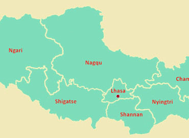
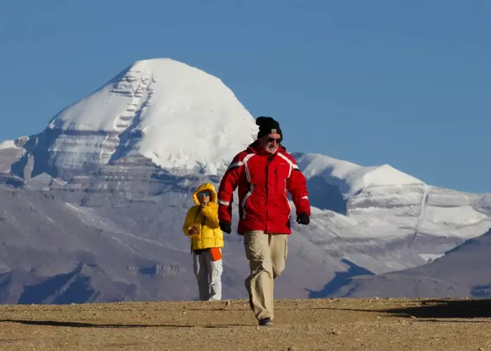
Zhangzhung is the name of the Tibetan Plateau before the rise of the Tubo Kingdom. It is divided into three parts: the inner, the middle and the outer, namely, historical territory centered on today's Zada County in Ngari Prefecture, Nyima County in Nagqu Prefecture and Zelzhol Monastery in Qamdo Prefecture. Xiangxiong culture originated from the Kailas Range in Ngari and centered on Mount Kailash. From the early stage, it stood in awe of the nature of the universe, like the primitive worship of sacred mountains, sacred lakes, and deities, then gradually formed the Bonpo religion. The Xiangxiong culture includes the systems of medicine, architecture, Buddhism, philosophy, astronomy, and more. After thousands of years of precipitation and accumulation, it has become the crystallization of the wisdom of the ancestors of the Tibetan Plateau.
People
The living habits of the people thriving on the Tibetan Plateau are summarized in short: the clothing is mainly Tibetan robes - Men wear trousers and women wear long skirts; their main food is Zanba, butter tea, beef, and mutton; people in pastoral areas live in tents; while people in rural areas live in 2-story or 3-story blockhouses or single-story wooden and stone houses.
Conclusion
The Tibetan Plateau stands as both a geographic wonder and a cultural heartland. Its towering landscapes, harsh climate, and unique ecosystems have shaped a distinct way of life and spiritual heritage. From the ancient Zhangzhung civilization to today’s Tibetan communities, the plateau continues to influence the identity and resilience of its people.
Email response within 0.5~24 hours.


