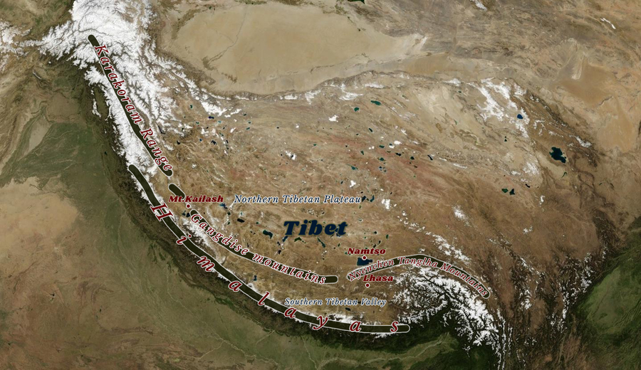
Gangdise Mountains
- Eric
- Last Updated : 05/21/2025
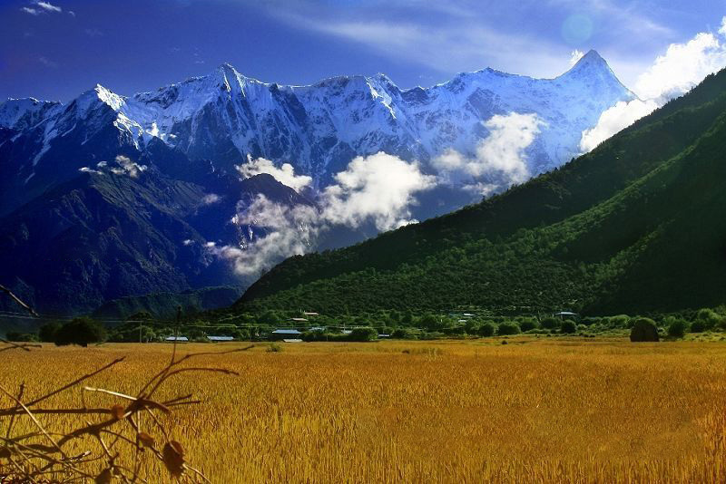
The Gangdise Mountains, also known as Gangdise Shan, and Kailas Range, traverse the southwestern part of Tibet, parallel to the Himalayas, in a northwest-southeast direction. It is the watershed between the inland water system and the Indian Ocean water system. On its north, there is the alpine northern Tibetan plateau. On its south, there is a cool Southern Tibetan Valley.
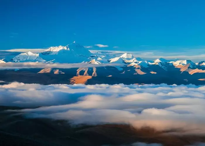
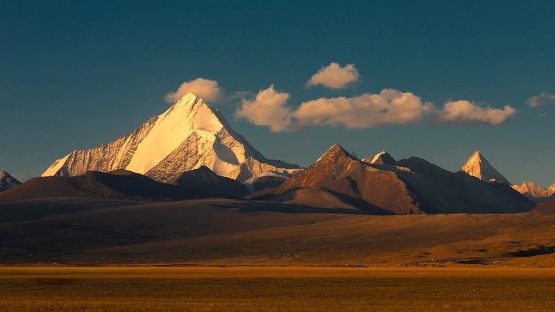
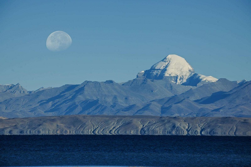
Gangdise means Lord of the Mountains in Tibetan. It is also called the "axis of the world". It is connected to the Nyenchen Tanglha Mountains in the east. Gangdise Mountain is 1100 kilometers long, at an altitude of about 6,000 meters. Its highest peak is Mt. Loinbo Kangri, at an altitude of 7,095 meters. However, its main peak is Mt. Kailash, located north of Manasarovar Lake, at an altitude of 6,656 meters with a snow line of 6,000 meters.
The north and south sides of the Gangdise Mountains are seismically active areas and after the 1970s, earthquakes of magnitude 6 or above have occurred many times.
Landforms
Gangdise Range is an important geographical boundary between the north and the south of the Tibetan Plateau, as well as the main watershed between the outflowing water system of the Indian Ocean in Tibet and the inflowing water system in northern Tibet.
The Gangdise Mountains start from the Sassel Ridge in the southeast of the Karakoram Range in the west(34°15′ N, 78°20′ E), and extend east to southwest of Namtso(about 29°20′ N, 89°10′ E), connecting to the Nyingchi Tanggula Range. The altitude of the mountains is generally 5500-6000 meters. The west section presents in the southeast direction, and the main branch Along Ganlei Mountain is parallel to the north side of the chain in the same direction, and the width of it is about 60-70 kilometers. The main peak of Gangdise mountains is Kailash, also known as Kailas Peak in Sanskrit, which is a famous holy mountain all around the world.
The highest peak is Lunpo Gangri (also known as Loinbo Kangri), with an altitude of 7,095 meters in the eastern section of Gangdise mountains.
Topography
The Gangdise Mountains began to uplift around the middle of the Cretaceous and then rose strongly after the early Eocene. It is believed that the Gangdise Mountains are the result of the collision, extrusion, fracture, and folding of the Indian block and Asian block in the mid-to-late Eocene, and the suture line between the two blocks is in the southern foothills of the Gangdise Mountains and the Indus River basin – Yarlung Tsangpo River valley.
Research by Chinese scientists shows that the eastern part of the Tibetan Plateau rose to its present elevation 34 million years ago and closed off the eastern end of this central valley, together with the Gangdise Mountains and the Central Dividing Range, to constitute the high-altitude topography of the Tibetan region in the late Eocene.
Climate Characters
The southern side of the Gangdise Mountains is commonly known as southern Tibet, where the climate is cool and slightly dry. The Yarlung Zangbo River Valley below 4,000 meters above sea level is shrub grassland, and the higher areas are subalpine grassland. This area has vast grasslands and concentrated arable land, also the region with a concentrated population and developed agriculture and animal husbandry in the Tibet Autonomous Region. The north side of it is the inflow area of the Qiangtang Plateau, with a severe cold and dry climate, dominated by alpine grasslands. Most of the land is only suitable for grazing sheep and yaks or is uninhabited wilderness.
Religious Culture
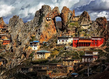
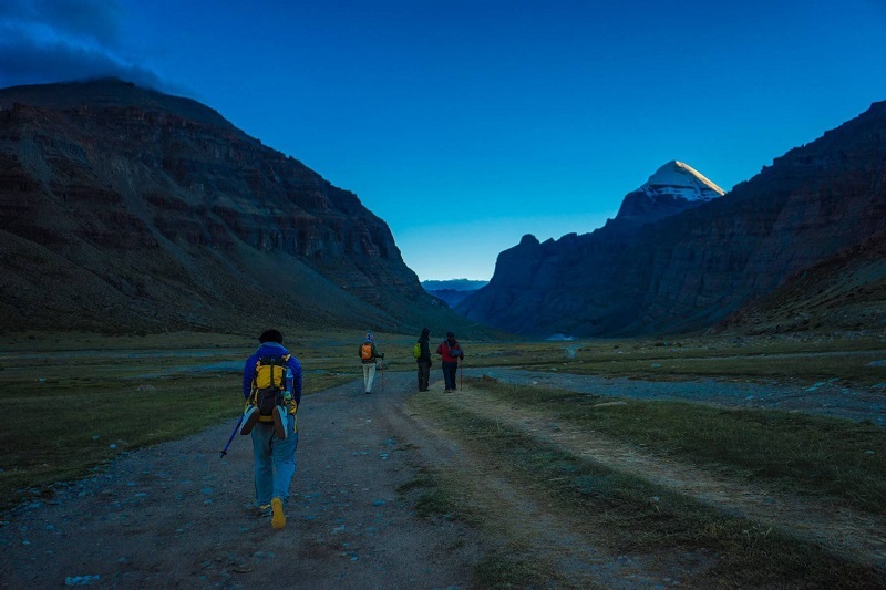
Gangdise has been a holy place of worship and pilgrimage for people from all over Central and South Asia since ancient times.
In Tibetan Buddhism, Gangdise Mountain is a sacred mountain. According to Tantric Buddhism, it symbolizes Chakrasamvara and Vajravarahi; some Buddhists believe that the Shakyamuni Buddha resides on this mountain, accompanied by five hundred arahats.
There is a temple in India called "Shiva Temple", which is called "Khandbahale" in Hindi, and its architectural structure is also similar to this mountain. Jainism also regards Mount Gangdise as a spiritual holy mountain, and it is the place where the founder of the religion, Rishabhadeva, attained liberation.
The Bon religion regards Mount Gangdise as the center of the universe, the lord of the mountains, the residence of the gods, and the ladder for the gods to descend to the earth and ascend to heaven. Also, 360 gods of Bon religion live in this mountain. Gangdise Mountain and its surrounding lakes, rivers and other nature have created the Bon religion, which advocates nature worship. Therefore, the ancient Tibetans had reverence for it and then worshiped it, and respected it as the soul mountain of the Zhang Zhung Kingdom.
Nepalese and Indians regard the mountain as the paradise of Shiva (one of the three Hindu gods), Manasarovar is the holy lake. Many pilgrims come here to worship. Hindus believe that as long as they have worshiped Mount Gangdise, other mountains do not have to worship. Having kora around Mt.Kailash once can wash away the sins of a lifetime; having kora around Kailash for ten times can avoid the suffering of hell for five hundred reincarnations; having kora around Kailash for a hundred times can ascend to heaven and become a Buddha. Especially in the Year of the Horse, pilgrims believe that one pilgrimage to Gangdise in the Year of the Horse is equivalent to thirteen pilgrimages in other years because all gods will gather here this year.
Ancient Commercial Road
In the history of cultural exchanges between the East and the West, Mount Gangdise occupies a unique position. In ancient times, there was a famous trade route leading to Central Asia and Europe, which became the second ancient road connecting Eurasia, also known as the "Musk Road". This commercial road not only connected Eastern and Western economies but also exchanged and integrated the cultures of Eastern and Western.
Tibetans are willing to trace the roots of their aboriginal culture to Arabs in the West, which shows that there has been a history of communication and integration between Tibetan culture and Western culture, especially with the cultures of Central Asia since ancient times.
Routes
There are five routes to get to Gangdise Mountain:
- Indian pilgrimage route: Lipulekh - Taklakot (Purang) - Darchen.
- Nepali pilgrimage route: Kathmandu- Nepalgunj- Simikot- Hilasa(involved in 3 flights)- Darchen / Kathmandu - Zhangmu(only Gyirong available now) - Saga - Darchen(overland).
- Ngari North route: Lhatse- Tsochen - Gertse - Gakyi - Senge- Tsangspo - Darchen.
- Ngari South route: Saga - Zhongba - Baga - Darchen. The southern route is the most direct route to Gangdise Mountain. Along the upper canyon of the Yarlung Tsangpo River, you can enjoy the snowy peaks of the Gangdise and Himalayas and see Tibetan antelopes on the way.
- Xinjiang-Tibet route: Kashgar - Karghalik - Mazar Pass - Domar - Rutog- Senge-Tsangspo - Montser - Darchen, 1,671km away from Kashgar.
Email response within 0.5~24 hours.