At a height of 8,848 meters (29,029 feet), Mount Everest - the highest Himalayan peak, stands as the highest mountain in the world. In Tibetan, Mt.Everest is also called Mount Qomolangma. "Qomo" means "goddess", and "Langma" means "mother elephant". The overall meaning is "Goddess of the earth." The official Chinese transcription is 珠穆朗玛峰. In the West, this mountain is generally called Mount Everest, in commemoration of George Everest, Director of the Survey of India. He was responsible for surveying the Himalayas when the British occupied Nepal. The Nepalese name is Sagarmatha, which means "goddess of the sky". It is home to the Sherpa tribe and several other indigenous groups.
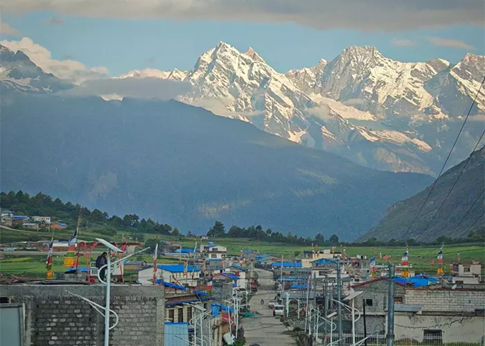
Mt.Everest is located in the middle section of the Himalaya mountain range, on the border of the Tibet Autonomous Region of China and Nepal. The northern part of Mt.Everest is in Tingri county, Tibet, while the Northern part of Mt.Everest is in Nepal. The highest mountain in the world is also the center of the Everest Nature Reserve in Tibet and Sagarmatha National Park in Nepal.
Landform
Mount Everest is shaped like a giant pyramid, with extreme and steep terrain and its environment is very complex. Snowline altitude is 5,800-6,200 meters on the north slope and 5,500-6,100 meters on the south slope. Three steep walls (the north, east and southwest) are sandwiched between the northeast ridge, southeast ridge, and west ridge. Between these ridges and cliffs, there are 548 continental glaciers with a total area of 1,457.07k㎡ and an average thickness of up to 7,260 meters. The supplies of glaciers mainly depend on snow metamorphism in the two precipitation zones of the Indian Ocean. On the glacier, there are various and rare ice tower forests, ice cliffs of tens of meters high, light and dark ice fissures of step traps, and dangerous ice avalanche areas.
The Rongbuk Valley is located on the north side of Mount Everest, formed by the melting of the Rongbuk Glacier under the peak. The altitude of the valley drops sharply from the top of Mount Everest to the north, and the slope gradually slows down until it is below 6,500 meters. At an altitude of 5,400-7,500 meters, it is almost entirely covered by glaciers.
Within 20km of the mountain, there're more than 40 peaks above 7,000 meters high (including independent peaks), including the famous Lhotse (at 8,516 meters, the fourth highest mountain in the world), Makalu (at 8,463 meters, the fifth highest mountain in the world), Pumori peak (at 7,161 meters), Changtse (at 7,534 meters), Nuptse (at 7,861 meters), Pumori (at 7,161 meters), etc. On the periphery of these peaks, there are some super high mountains facing Mount Qomolangma over a long distance, such as Kangchenjunga (at 8,586 meters, the third highest mountain in the world), Gyachung Kang (at 7,952 meters), Cho Oyu (at 8,201 meters) and Shisha Pangma (at 8,012 meters). As a result, the peaks around Mount Everest formed a magnificent scene.
Weather Condition
Mount Everest has a majestic peak and a unique geographical environment. The lowest temperature at the top of the peak is minus thirty or forty degrees Celsius all year round. In some places on the mountain, snow does not melt all year round; glaciers, ice slopes, and ice towers can be seen everywhere. The air at the top of the peak is thin, and the oxygen content of the air is only a quarter of that in the plains. It often blows gales of level seven to eight, and even a twelve-level gale is not uncommon. The wind blows the snow, flying in all directions, filling the sky.
The climate in the Everest region and its nearby peaks is complex and changeable. Even within a day, it is often unpredictable, not to mention the changeable weather in the four seasons of the year. Generally speaking, the rainy season is from early June to mid-September every year. The strong southeast monsoon causes frequent heavy rains, clouds and fog, and ice and snow ravage the harsh climate. From mid-November to mid-February of the following year, due to the strong northwest cold current, the lowest temperature can reach -50℃ and the average temperature is around -30℃. The maximum wind speed can reach 90 meters per second. From the beginning of March to the end of May each year is the spring, when the wind season transitions to the rainy season, and from the beginning of September to the end of October is the autumn, when the rainy season transitions to the wind season. During these two seasons, there may be better weather, which is best for mountaineering. Due to the extremely cold climate, it is also called the third pole in the world. According to radiosonde data from the Tingri weather station at the foot of Mount Everest, at an altitude of 7,500 meters, the coldest month is February and the average temperature is -27.1 ℃, the hottest month is August, the average temperature is -10.4℃, and the annual average temperature is -19.6℃.
Travel Info
If you have decided to climb Mount Everest and you're healthy enough without asthma, heart disease, hypertension, and other diseases, then you can move on to the next step - preparing for Mount Everest. It's not an easy task, as this process will take 3 to 4 years. The first step is low-altitude outdoor activities, physical training, and basic technical learning. Physical training is mainly to improve endurance, cardiopulmonary function, leg, waist and abdomen strength, and carrying capacity. If a novice can use all the weekends, this stage can be completed within a year. The second step is to enter the thin air zone at high altitude. Before climbing Mount Everest, it is best to have 2 to 3 high-altitude mountaineering experiences. With a gradual approach, healthy climbers can start with 6,000-meter peaks and then move on to higher ones like 7,000 and 8,000 meters. This stage takes 1 year at the fastest and generally takes 2 to 3 years. The third step is the preparation stage for Everest climbing. It takes at least half a year for preparations, especially physical training and reserves.
How to Get to Mount Everest from Lhasa
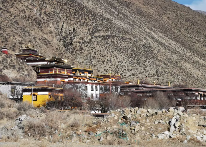
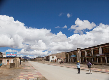
Currently, many travelers get to Mt. Everest from Lhasa. If you just want to have a glimpse of Mt.Everest, you can join Everest Base Camp tours. As foreign travelers are not allowed to visit Tibet alone, you need to join an organized tour by a local Tibet travel agency to get your Tibet Travel Permit, which is the legal document to board the train/plane to Tibet. You will drive along the Sino-Nepal highway via Yamdroktso Lake, Gyantse, Shigatse, Shegar, Rongbuk Monastery, and Mount Everest, with a total distance of 670 kilometers, traveling for two days.
If you are planning to climb this awe-inspiring mountain and have experience climbing 8,000-meter peaks before, you must begin your preparations as soon as possible. First of all, you need to apply and get permission from the Tibet Mountaineering Management Center. Then you need to pay via the Tibet Mountaineering Association for joining the expedition. The cost would be about USD 60,000 in total. For more documents and details, you can check Everest Expeditions.
Conclusion
Going to Everest is a huge feat for anyone. Even if you are not used to high altitudes and mountaineering, we would recommend that you visit Everest Base Camp once in your life. It doesn't matter if you are going by car, bike or on foot. As soon as you reach the foot of the peak, you will realize that it’s all worth it.
Attractions nearby Mount Everest
Email response within 0.5~24 hours.