Kathmandu Altitude: Elevation List of Main Areas and Nearby Travel Destinations
- Zoe
- Last Updated : 10/23/2024
As the cultural and economic center of Nepal, Kathmandu is also the country’s capital and largest metropolis. This city is located in the Kathmandu Valley in central Nepal. The bottom of the valley is 25 kilometers from east to west and 20 kilometers from north to south, with an average altitude of 1,370 meters. The entire city is surrounded by mountains with an elevation of 1,500 to 2,800 meters. Dozens of rivers pass through this valley to join the sacred Bagmati River, and then flow south through the Chobar Gorge and finally into the Ganges.
Kathmandu is regarded as the gateway to the Himalayas and it's a very popular tourist destination. As a low-altitude city, altitude sickness has never been a problem in Kathmandu. but because Nepal is one of the highest countries on earth. When preparing for a trip to Nepal, tourists can refer to the following elevation information about Nepal and Kathmandu.
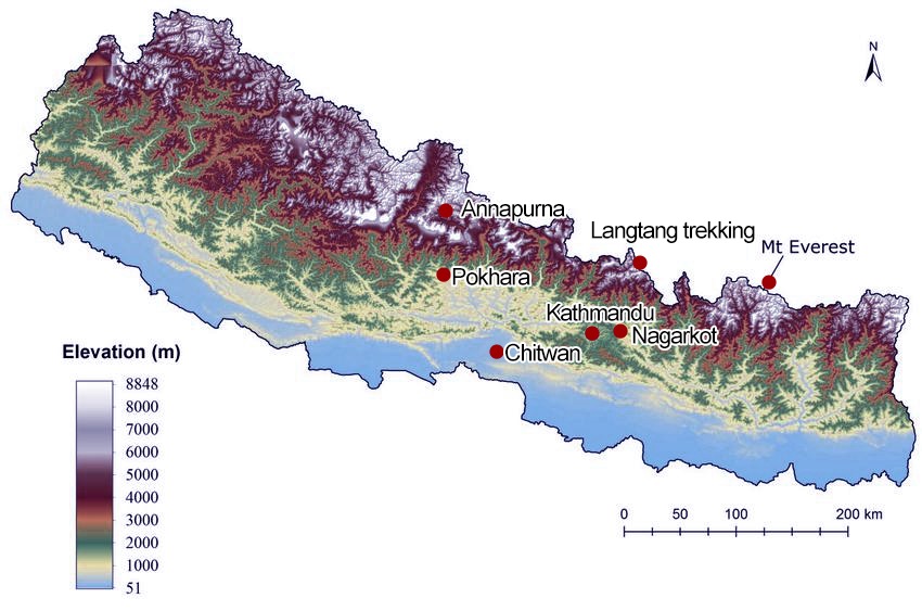
The Altitude of Main Areas in Kathmandu
Although the average altitude of Kathmandu is 1,400m, which is far lower than the national average of Nepal, it is still relatively higher compared to most cities in the world. According to the geographical classification, there are actually three districts in Kathmandu, namely, Kathmandu, Patan and Bhaktapur, which are also the most popular areas for tourists.
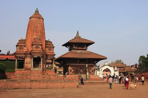
Altitude of Kathmandu
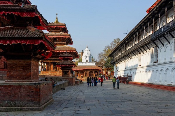
Located at the confluence of the Bagmati and Bishnumati rivers, the core area of the Kathmandu Valley, with an elevation of 1,280 meters to 1,340 meters, is the lowest point in the Kathmandu Valley. Built-in 723, it was originally named Kantipur, which means "City of Light". In the 16th century, it was renamed Kathmandu, which means " Temple of a Single Wood " in Nepalese. There are more than 2,700 large and small temples in the city, so it is known as "the city of temples". There are many famous buildings such as the old palace -- Numandoka Palace, the New Palace -- Narayanshiti Palace, the Swayamb Buddha House, the Pashupatinath Temple, Taleju Temple, the Five-storeyed Pagoda and so on.
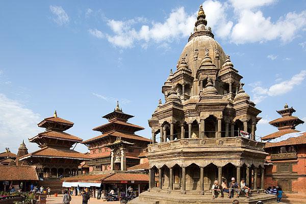
Altitude of Patan
Patan is located on the bank of Bagmati River, 5km south of Kathmandu. The average altitude of the area is about 1,300 meters, and the highest point is about 2,300 meters. Built-in 298, Patan means "Commercial city" in Nepalese, and it was an ancient commercial center of Kathmandu Valley. The city was designed in the shape of a Buddhist Dharma Wheel, with four gates on all sides and a pagoda in the shape of a covered bowl in the middle. Outside the city, there are pagodas standing on four mounds in the east, south, west and north of the city, which were built by King Ashoka of India before Christ. Inside the city, there are magnificent palaces, surrounded by temples and minarets.
Altitude of Bhaktapur
Bhaktapur is located 12 km east of Kathmandu. The average altitude of the Bhaktapur region is about 1,320 meters and the highest point is only 1,350 meters above sea level. Built in 389, the city was built along the slope of hillsides, in a trapezoidal shape. At the beginning of the 13th century, the Malla Dynasty established its capital here, which became the political and cultural center of Nepal, as well as the birthplace of architectural art. Famous buildings are the Palace of Fifty-five Windows, Nyatapola Temple, Changu Narayan, Peacock Window, and so on.
The Altitude of Nearby Travel Destinations
As the first stop for tourists to Nepal and the transportation hub of the country, Kathmandu is a must-see place before heading to other places in Nepal. Although Kathmandu is not high in altitude, Nepal, as the highest altitude country in the world, has large elevation differences in various regions. Here is the altitude of the main travel destinations around Kathmandu.
Lower Altitude Places
Chitwan is located in the Rapti River Valley, which is 120 kilometers southwest of Kathmandu. It covers an area of 980 square kilometers and is 150 meters above sea level. Chitwan National Park is the largest wildlife park in Nepal and one of the largest forest parks in Asia. It was once the Royal Park of Nepal and the first national park in Nepal.
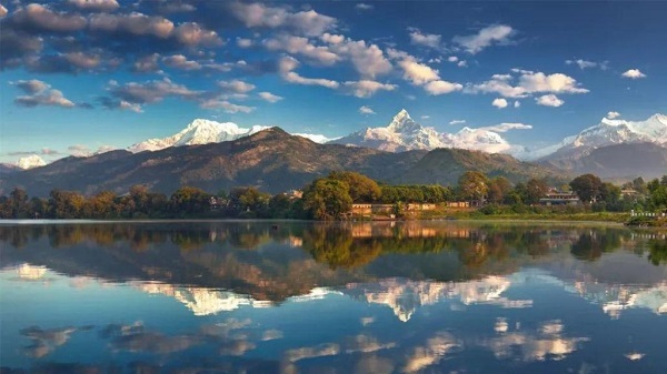
Pokhara is located in the Pokhara Valley on the southern slope of the Himalayas in central Nepal, about 200 kilometers east of Kathmandu, at an altitude of 900 meters above sea level. Its basic terrain is low mountains and hills, and the river valley is wide and flat. Pokhara is the second-largest city in Nepal and the most famous scenic spot in Nepal.
Nagarkot is a village on a ridge facing the Himalayas, which is only 32 kilometers from Kathmandu. At an altitude of 2,175 meters, Nagarkot is called "the viewing platform of the Himalayas". It provides the broadest and most beautiful view of the world's highest peak.
Higher Altitude Places
Mt. Everest, the highest peak in the world, is 8848.86 meters above sea level. It's 200 kilometers from Kathmandu. Although Mt.Everest is not too close to Kathmandu, it is definitely the starting point for all Everest trekking as most tourists choose to fly from Kathmandu to Lukla to start the EBC Trek.
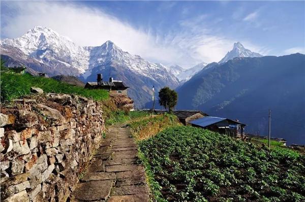
Annapurna is the tenth-highest peak in the world, with an altitude of 8,091 meters. It is located in the middle of the Himalayas in Nepal, which is 174 kilometers from Kathmandu. As the first official national nature reserve in Nepal, it covers an area of 7,629 square kilometers and is also the most famous trekking area in the world.
Langtang is located in the Rasuwa region, which is 51 kilometers north of the Kathmandu Valley. Langtang is famous for its fascinating views of the valley, glacial lakes, and mountain peaks. Langtang is the most satisfying short hike trail in the Himalayas, and Langtang is easy to get to from Kathmandu Valley. This is also the only trekking route starting from Kathmandu Valley.
How to Deal with Altitude Sickness When Traveling in Nepal?
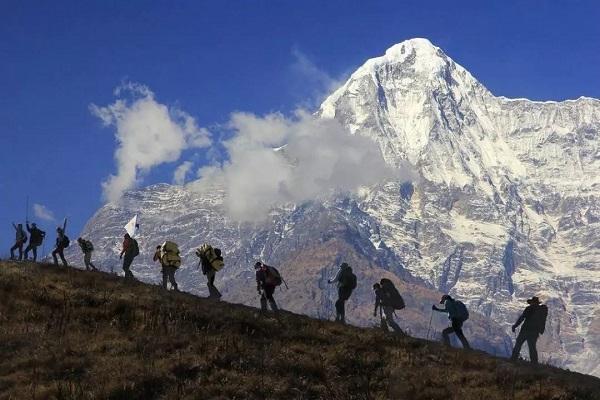
Nepal is a valley area, so there is no need to worry about altitude sickness when traveling to Nepal. Since Nepal is located near the Himalayas, the highest mountain in the world, tourists regard it as the gateway to the Himalayas, and at the same time worry about whether there will be a high altitude during the journey. In fact, if you are not hiking in Nepal, you don't have to worry about altitude sickness. Take the most famous Annapurna Base Camp Trek (ABC) as an example, people will only stay in the area at 4,000m for two days, which can be adopted by most travelers. After all, they have gradually accustomed to altitude in the first few days of trekking.
How to Handle Altitude Sickness?
The main tourist cities in Nepal are less than 2,000 meters above sea level, and there is almost no altitude sickness. However, if it is due to fatigue on the road and a weakened physique, it may also cause altitude sickness. It's a normal physiological response of human physiology to the lack of oxygen at high altitude areas but it‘s different from person to person. Just pay attention to rest, don't do too intense exercise (such as short-distance accelerated running), don't be too excited (such as happily chatting with your partner), and drink plenty of water, in most cases, the altitude sickness symptoms will gradually disappear within one to two days.
Email response within 0.5~24 hours.