Maps of Kathmandu
- Last Updated : 04/02/2025
Located in the Kathmandu Valley, Kathmandu is the capital and largest city of Nepal, at1,370 meters above sea level. It's surrounded by mountains and with a resident population of more than 410,000. This ancient city was founded in 723, and now it has a history of more than 1,200 years. Kathmandu is a symbol of ancient Nepalese culture with its exquisite architectural art as well as wood and stone carvings. There are many places of interest in the city, such as Kathmandu Durbar Square, Bhaktapur Durbar Square, Patan Durbar Square, Swayambhunath Stupa, and so on. Kathmandu is also a transportation hub for foreign tourists to travel to Nepal. Whether you want to go to Pokhara, Chitwan, Lumbini and other tourist destinations in Nepal, you can easily reach it from Kathmandu.
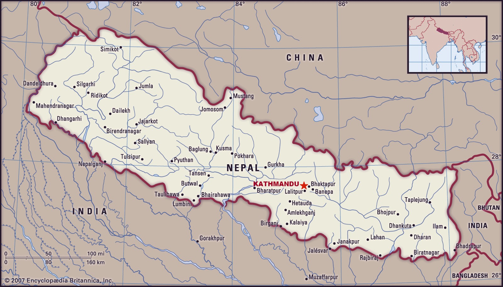
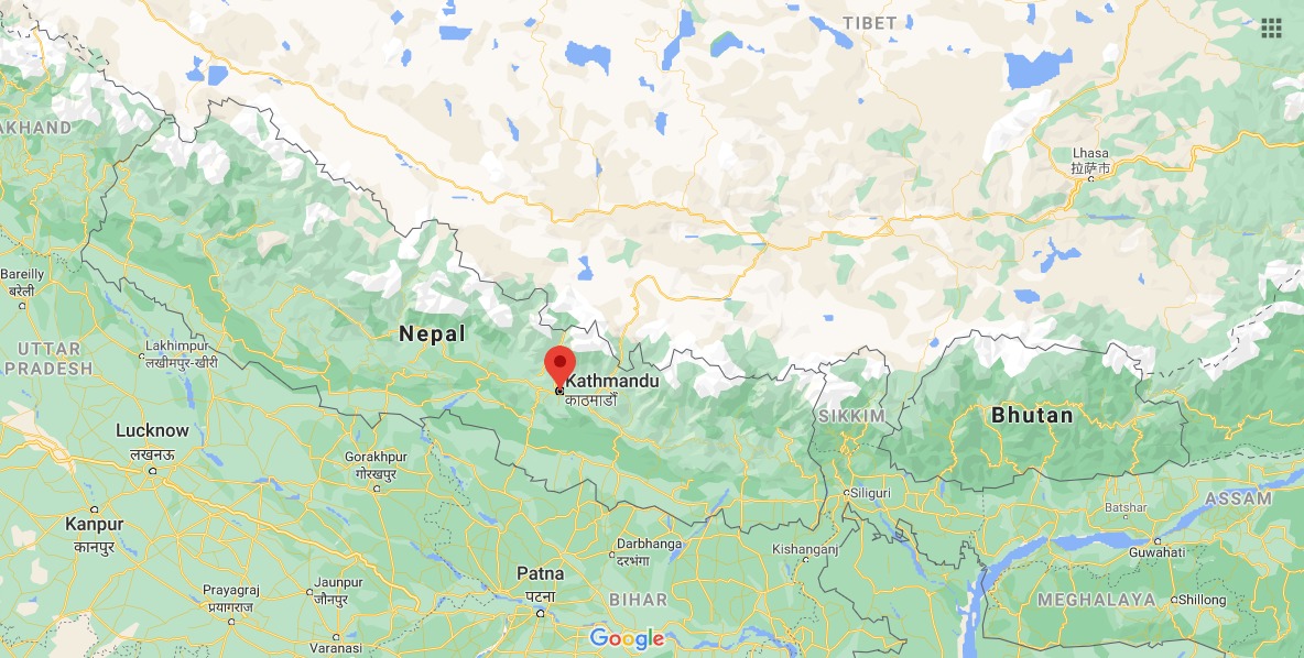
Where is Kathmandu Located?
The location of Kathmandu is on the southern slope of the Himalayas. It's situated in Kathmandu Valley of the central Bagmati zone, about 3 kilometers north of Patan, 13 kilometers west of Bhaktapur.
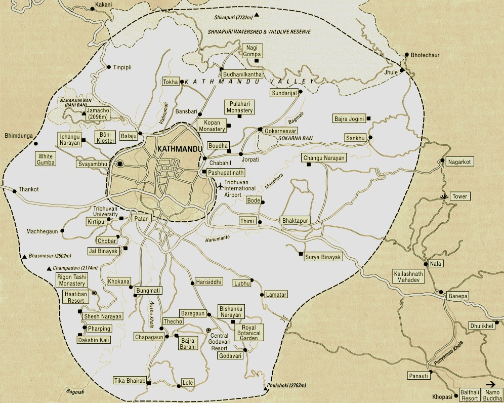
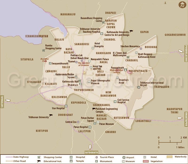
Kathmandu City Map
Kathmandu is also an important tourist and sightseeing center. The weather here is agreeable, like spring all year round, with an average annual temperature of about 20°C. The ancient buildings in Kathmandu can be seen everywhere and become unique historical heritages.
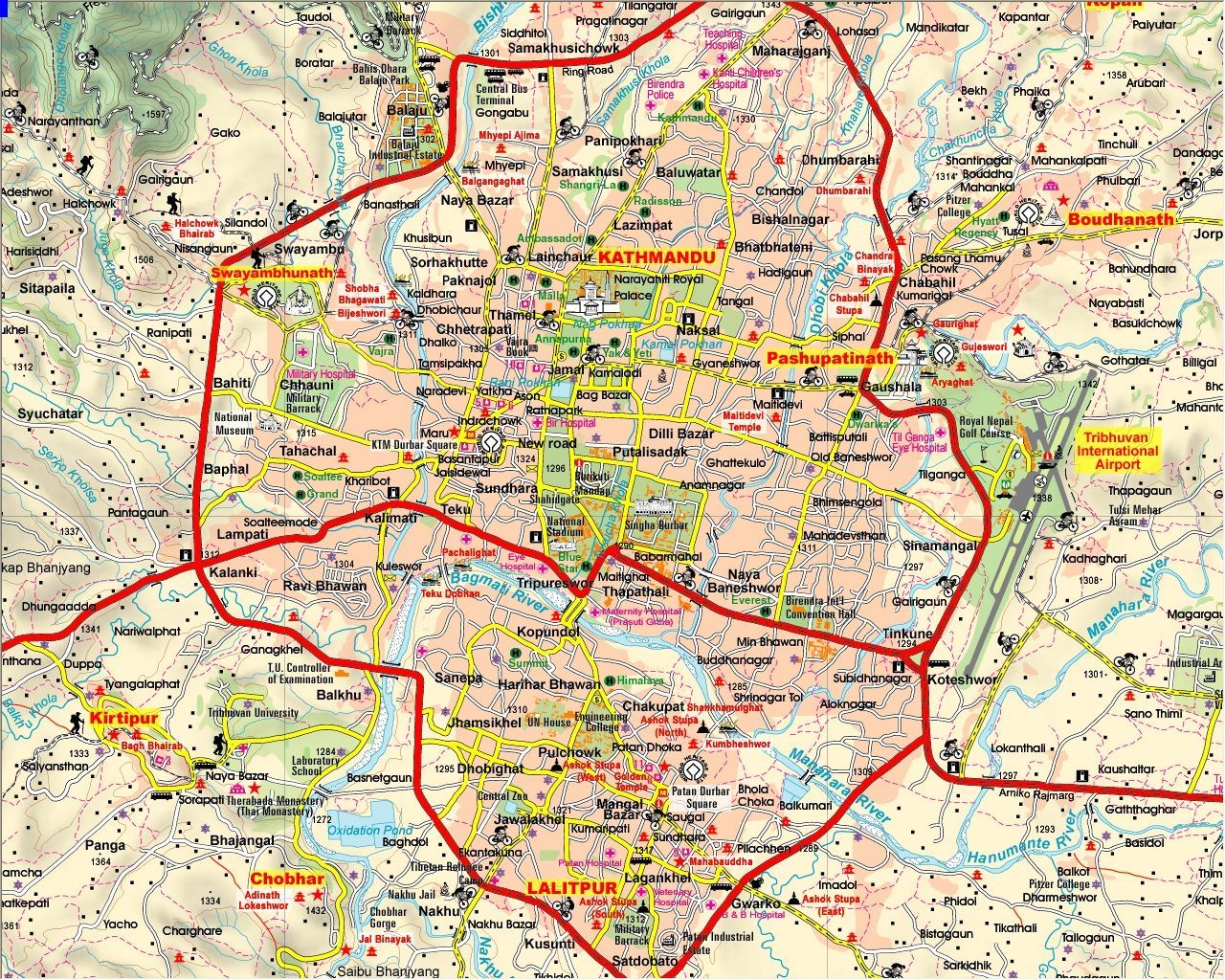
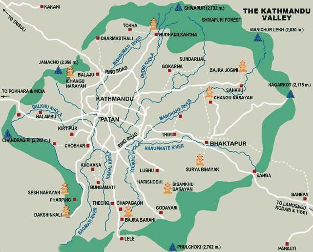
Kathmandu Tourist Map
Kathmandu has been the political and cultural center of Nepal since ancient times, and it is also a place where ancient civilizations exchanged and converged. There are more than 130 cultural sites, including many Hindu and Buddhist holy sites. The Kathmandu Valley, including Kathmandu, Patan and Bhaktapur, is the crossroads of the splendid cultures and has seven world cultural heritage sites here.
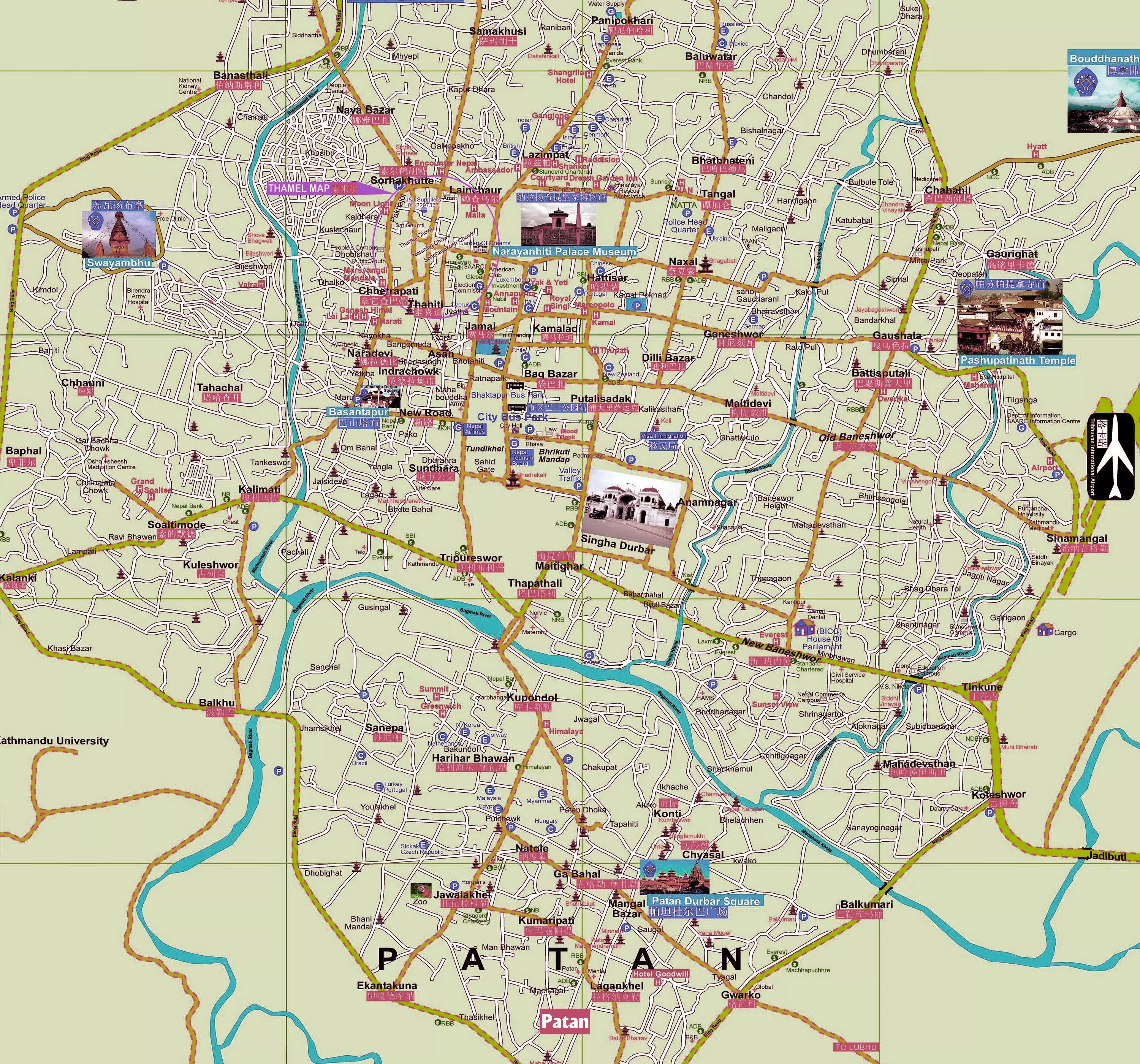
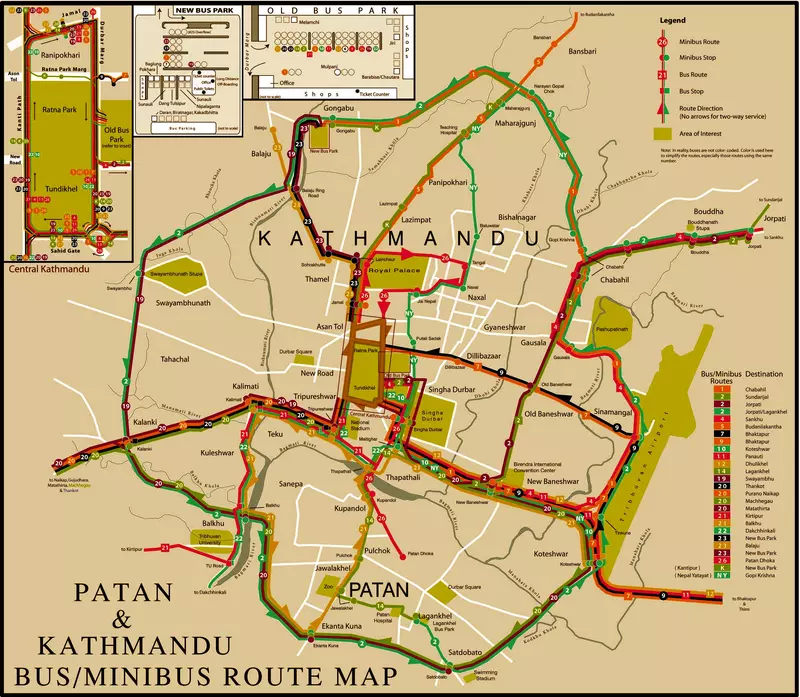
Kathmandu Transportation Map
Kathmandu is a transportation hub for foreign tourists to travel to Nepal. Tribhuvan International Airport is the only international airport in Nepal, located 5 kilometers east of Kathmandu. There are very cheap buses and minibusses in Kathmandu, but it is difficult to figure out the route. The most convenient way of transportation within the Kathmandu ring road is by taxi. Please always bargain before riding. You can also take a bus to the nearby cities and towns from the Ratna Park City Bus Terminal, which is located east of Tundikhel Square in the city center.
Email response within 0.5~24 hours.