Tibet Geography
- Zoe
- Last Updated : 10/24/2024
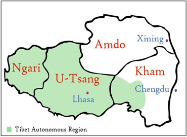
The Tibet Autonomous Region is located in southwestern China, covering an area of 1.23 million square kilometers, accounting for about 1/8 of China's total land area. Among China's provinces and regions, it is second only to the Xinjiang Uyghur Autonomous Region in area, which is equivalent to the total area of the five countries of Britain, France, Germany, the Netherlands and Luxembourg. Tibet is adjacent to the Xinjiang Uygur Autonomous Region and Qinghai Province to the north, Yunnan Province and Sichuan Province to the east and southeast, and Myanmar, India, Bhutan, Nepal and other countries from the east to the west to the south and west.
Known as the latest uplift with the largest area and the highest elevation, Tibetan Plateau is honored as the "Roof of the World" and the "Third Pole of the Earth". Tibet is the main part of the Tibetan Plateau.
Administrative Region of Tibet
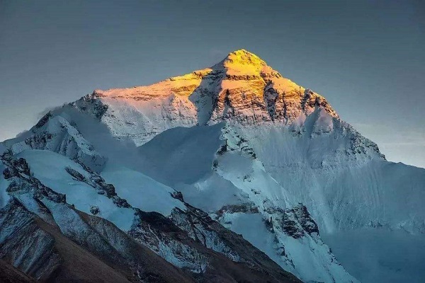
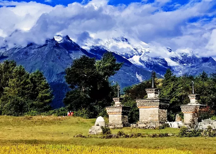
Tibet is divided into seven prefecture-level administrative regions. Among them, Lhasa, the smallest one, is the capital with the well-known landmark Potala Palace. Nagqu is the largest prefecture in the north of Tibet with wild prairies. The famous Mount Everest stands at the junction between Shigatse prefecture and Nepal. Mount Kailash lies in Ngari prefecture. Besides, there are three other prefectures of Lhoka, Nyingchi and Chamdo.
Terrain and Mountains of Tibet
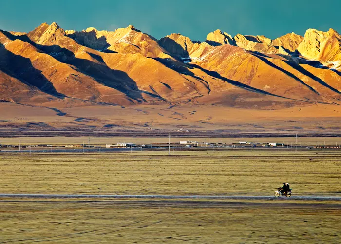
The Tibet Autonomous Region has an average elevation of more than 4000 meters and is the main part of the Tibetan Plateau. The terrain is complex and diverse, with a variety of sceneries, including high and steep mountains, cliffy and deep gorges, glaciers, bare stones, Gobi, and other landform types. The landform can be roughly divided into the Himalayas Alpine Region, the South Tibetan Valley, the North Tibetan Plateau and the East Tibetan Alpine Valley.
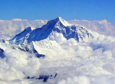
1. The Himalayas Alpine Region, located in southern Tibet, consists of several mountain ranges that extend roughly from east to west, with an average elevation of about 6000 meters. Mount Everest, located on the border between China and Nepal in Tingri County, Tibet, has an elevation of 8848.86 meters and is the highest peak in the world. The top of the Himalayas is covered with snow and ice all year round, and the climate and landforms on the north and south sides are quite different.
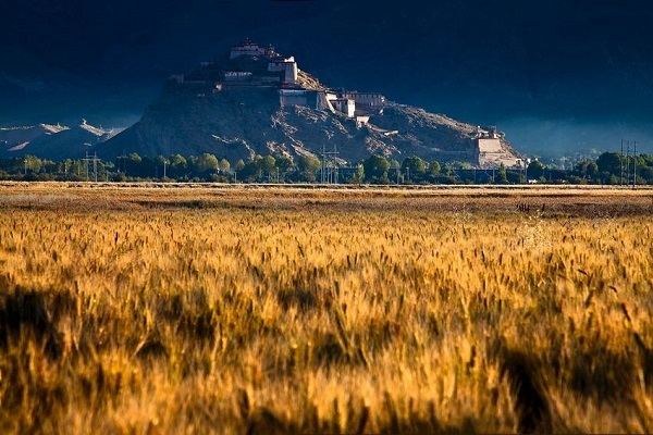
2. The South Tibetan Valley is located between the Gangdise Mountains and the Himalayas, where the Yarlung Tsangpo River and its tributaries flow through. There are many river flatlands and lake basin valleys of different widths. The terrain is plain and the soil is fertile, so it's the main agricultural area in Tibet.
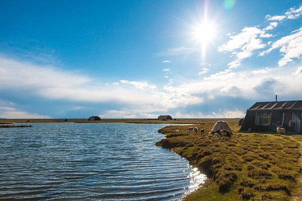
3. The North Tibetan Plateau is located between the Kunlun Mountains, Tanggula Mountains, Gangdise Mountains and Nyenchen Tanglha Mountains, which account for two-thirds of the total area of the Tibet Autonomous Region. It consists of a series of round and gentle hills with many basins among them. It is the main pastoral area in Tibet.
4. The East Tibetan Alpine Valley is the famous Hengduan Mountains. Roughly to the east of Nagqu, it is a series of high mountains and deep valleys that gradually turn from east to west to north-south. Three major rivers, the Nu River, the Lancang River and the Jinsha River are held in between. The everlasting snow on the top of the mountain, the dense forest on the mountainside and the evergreen pastoral foothill, together with the three rushing rivers, form a magnificent landscape of three parallel rivers in the canyon area.
Rivers and Lakes of Tibet
Within the territory of Tibet, there are more than 20 rivers with a drainage area greater than 10,000 square kilometers, and more than 100 rivers with a drainage area greater than 2,000 square kilometers. The famous rivers are the Jinsha River, Nu River, Lancang River and Yarlung Tsangpo River. Tibet is also a Chinese province with the most international rivers. The sources of the famous Asian rivers such as the Ganges River, Indus River and Mekong River are all located here. The water sources of Tibet's rivers are mainly composed of rainwater, melted ice and snow, and groundwater. They have the characteristic of rich flow, low sand content and good water quality. The Yarlung Tsangpo River is the longest river in Tibet, with a total length of 2,057 kilometers (within China) and an average elevation of about 4,500 meters. It's the highest river in the world. The Yarlung Zangbo River Grand Canyon is 5,382 meters deep and is the deepest canyon on earth. The total length is 370 kilometers. >>See more about rivers in Tibet
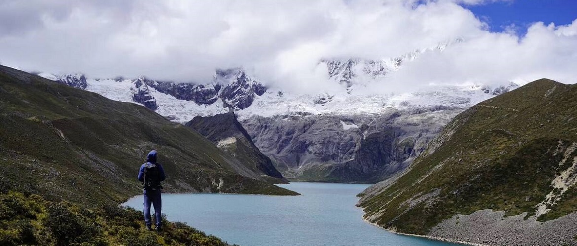
The vast Tibetan Plateau is dotted with more than 1,500 large and small lakes, of which Namtso Lake, Siling Lake and Zhari Namco Lake respectively cover an area of more than 1,000 square kilometers. Namtso is also one of the highest lakes in the world, occupying an area of 24,183 square kilometers and accounting for about one-third of the total lake area in China. The Tibetan Plateau is not only the largest dense lake area in China but also the plateau lake area with the highest lake level, the largest range and the largest number in the world. There are more saltwater lakes rather than freshwater lakes. Seventeen lakes are over 5,000 meters above sea level, covering an area of more than 50 square kilometers each.
Besides, the most famous lakes in Tibet include Yamdrok Lake, Manasarovar Lake, Pangong Lake, Draksum-tso Lake and Sengli Co Lake, etc. In Tibet, many lakes are endowed with religious significance. Namtso Lake, Manasarovar Lake and Yamdrok Lake are known as the "top three holy lakes" in Tibet. In addition, holy lakes also include Lhamo La-to Lake, which has a special position in the living Buddha reincarnation system of Tibetan Buddhism; Tangra Yumco Lake, which is the sacred lake of Bon religion; and Cona Lake in Amdo County, which is the "Soul Lake" of Reting living Buddha. >>See more about sacred lakes in Tibet
Climate of Tibet
The complex and diverse topography of the Tibetan Plateau has formed a unique plateau climate. In addition to the general trend of severe cold and dry in the northwest, warm and humid in the southeast, there are also various regional climates and obvious vertical climate zones. Proverbs such as “Ten miles with different weathers” and “four seasons in a day” reflect these characteristics.
The air in Tibet is thin, sunshine is abundant, the temperature is low and rainfall is less. The Tibetan Plateau contains only 150-170 grams of oxygen per cubic meter of air, which is equivalent to 62% to 65.4% of the plain area. Tibet is the place with the most solar radiation energy in China, which is twice or one-third more than the plain area at the same latitude. Meanwhile, the sunshine duration of Tibet is also a high-value center in China. The annual average sunshine hours in Lhasa is 3,021 hours. The temperature here is obviously lower than the plain area with the characters of small annual temperature differences but large temperature differences between day and night. The annual temperature difference(the average data between the highest temperature and the lowest temperature throughout the year) in Lhasa, Chamdo and Shigatse is 18 C° to 20 C°.
At places above 5,000 meters above sea level in the Ngari area, the temperature during the daytime in August is above 10 C°, while the nighttime temperature drops below 0 C°. The seasonal distribution of precipitation is uneven across the Tibet Autonomous Region. The distinction between the dry season and the rainy season is very obvious, and it usually rains at night. From October to April of the following year, precipitation only accounts for 10% to 20 % of the annual precipitation; whereas, from May to September, the rainfall is very concentrated, generally accounting for about 90% of the annual precipitation. >>See more about the climate of Tibet
Natural Resources of Tibet
The Tibet Autonomous Region is rich in land resources, with a total area of over 1.22 million square kilometers. Among them, 650,000 hectares are pasture grassland; the arable land is concentrated in the South Tibetan river valley and river valley basin, and a small amount is also distributed in the east and southeast, with a total area of 360,000 hectares. The largest cultivated soil area is in Shigatse, which accounts for 37.79% of the cultivated soil area in the entire district. Tibet's natural grassland area exceeds those of Inner Mongolia and Xinjiang, ranking first in China, and is one of the main pastoral areas in China.
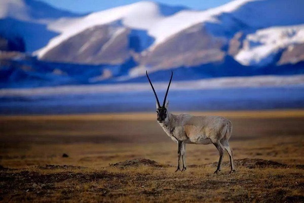
In addition to abundant land resources, Tibet also has many biological resources. At present, there are more than 6,400 kinds of higher plants, such as Himalayan fir, and unique animal resources such as Tibetan antelope. Moreover, Tibet's energy resources mainly include renewable energy like hydropower, solar energy, other renewable energy, and mineral resources.
Email response within 0.5~24 hours.