
Tingri

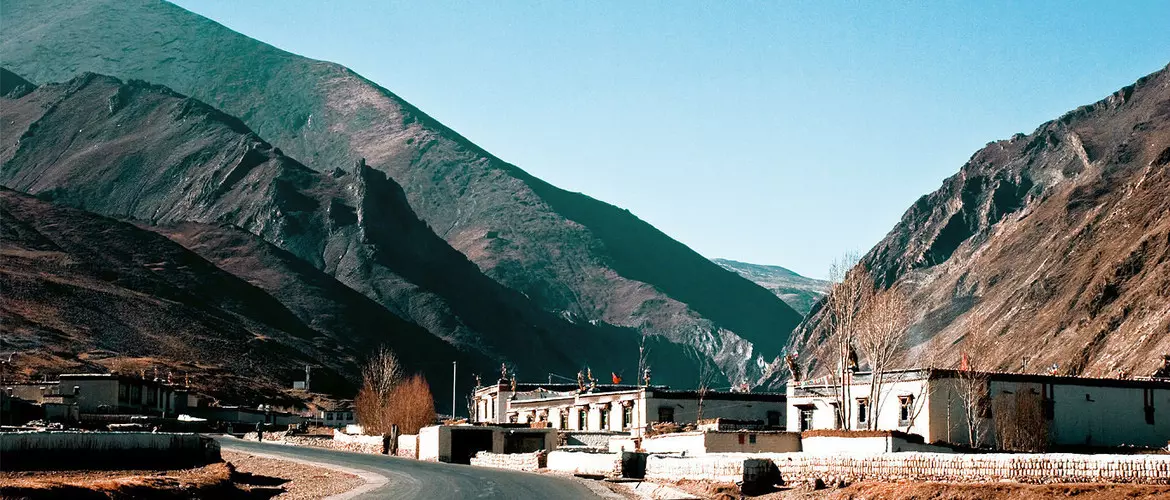
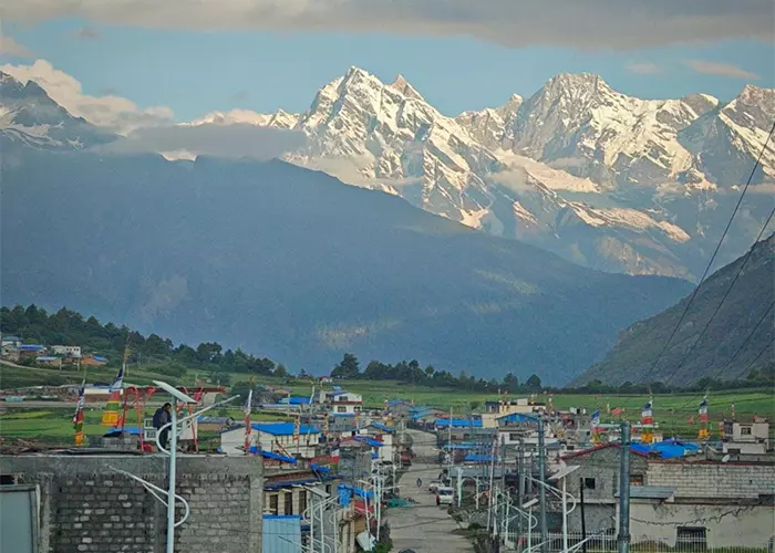
Tingri County or Dingri County, can be divided into old Tingri and new Tingri. Old Tingri refers to the seat of government of Tingri County before 1968, which is today’s Gangga Township; and New Tingri, Shegar Town, as its county seat, has now become the political, economic, and cultural center. Tourists basically stay in Shegar, which is 115 kilometers away from the Everest Base Camp. As long as the sky is clear, you can see Mount Everest on the side of the highway.
Regarding the origin of the name "Tingri", it is said that "Tingri" means "Certain Victory Hill" in Tibetan. Legend has it that a lama threw a stone, which ended up with the sound of "Tin". Later, a temple was built on a hill in the place, which was named Tingri Temple, and "Tingri" was used as the county name.
Geographical Condition
Tingri County is situated on the southwestern border of the Tibet Autonomous Region, at the northern foot of Mount Everest in the middle of the Himalayas. It's adjacent to Tingkye and Sakya counties to the east, Nyalam County to the west, Ngamring County to the north and Lhatse County to the northeast. In the south, Tingri borders the kingdom of Nepal.
Tingri is located between 86°20′-87°70′ east longitude and 27°80′-29°10′ north latitude. The county seat Shegar is 4,300 meters above sea level and the average elevation of the county is 5,000 meters. The total land area is approximately 14,000 square kilometers. It is 115 kilometers long from east to west and 152 kilometers wide from north to south. The borderline is 181 kilometers long.
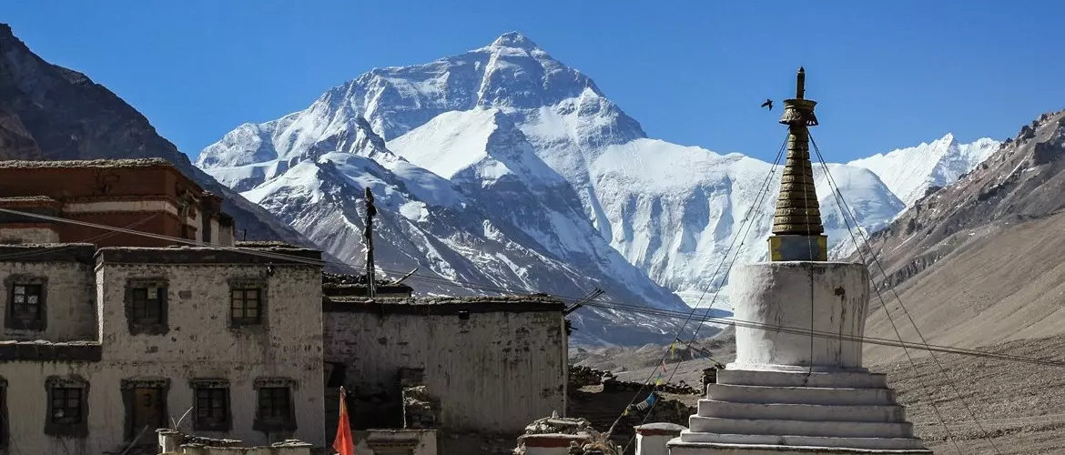
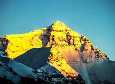
The main mountain ranges in the territory of Tingir are the Himalayas and the Lagagangri Mountains. Mount Everest, Lhotse, Cho Oyu, and Makalu are all above 8,000 meters above sea level. Especially Mount Everest, with an altitude of 8,844.43 meters, is the highest peak in the world, also known as the third pole of the world.
Weather in Tingri
Tingri belongs to the plateau temperate semi-arid monsoon climate zone, with a large temperature difference between day and night, dry climate, low annual rainfall, large evaporation, and long sunshine time (the annual average sunshine time is 3,393.3 hours). Due to the high altitude, there are strong ultraviolet rays and low temperatures, with an average annual temperature of 2.8~3.9℃. The coldest month is January, with an average temperature of -7.4°C; the hottest month is July, with an average temperature of 12°C.
Along the southern and southeast slopes of the Himalayas, Rongxia Valley, Tuolong Valley, and Gama Valley, there are the characteristics of the alpine and subtropical climate, with high humidity, warm climate and abundant precipitation.
Attractions in Tingri
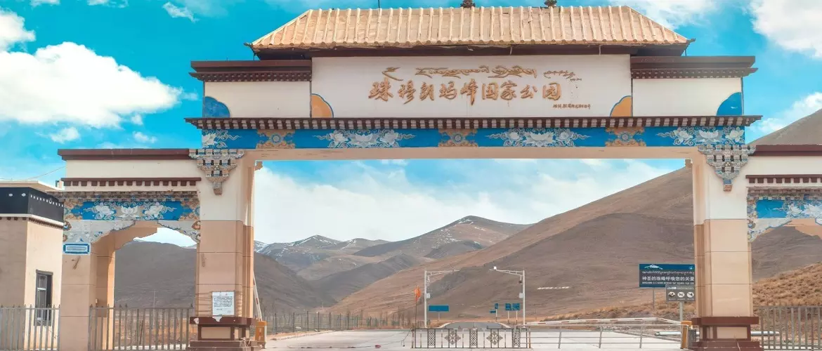
There are more than 50 peaks in Tingri County with an altitude of more than 7,000 meters, and four peaks above 8,000 meters, namely, Mount Everest, Lhotse, Cho Oyu, and Makalu. And, there's a national park - Everest Nature Reserve. The following are the most famous attractions in Tingri:
Everest Base Camp: It is the base for countless climbers, also the furthest place that tourists can reach. >>See more about Everest Base Camp
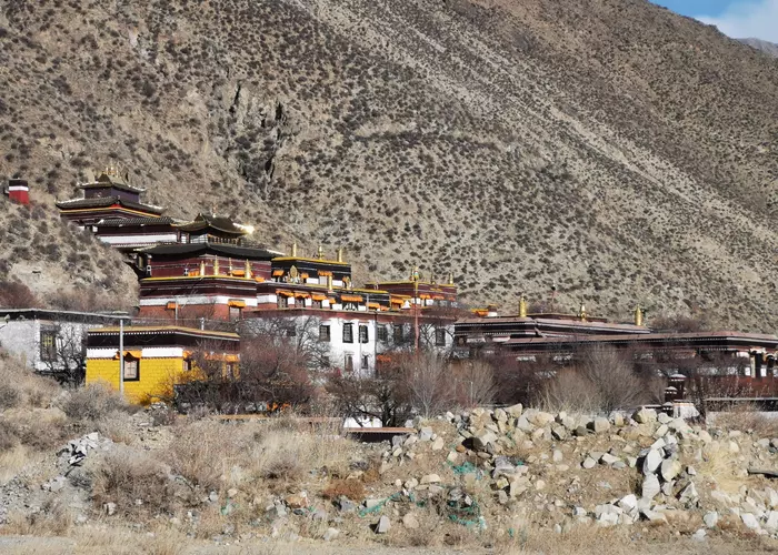
Rongbuk Monastery: Rongbuk Monastery is a Nyingma temple with an altitude of 5,100 meters. It is the highest temple and the highest residential area in the world, and it is also a great photography location to shoot Mount Everest. >>See more about Rongbuk Monastery
Gawula Pass: The only viewing platform in the world where you can see five peaks above 8,000 meters.
How to Get to Tingri?
Many tourists who want to go to Tingri's Everest Base Camp can start from either Lhasa or Kathmandu to Tibet's Everest Base Camp to get a close view of Mount Everest.
The distance from Lhasa to Tingri is about 506 kilometers. Since most sections of the journey are limited to 40km/h, it takes about 11-12 hours. Along the G318 national highway, one of the most beautiful highways in the world, it takes 5 hours to drive from Lhasa to Shigatse and then to Tingri for about 270 kilometers, which takes about four and a half hours.
If you get to Tingri from Kathmandu, it will be slower. You can enter the Gyirong Port of China from Kathmandu, with a distance of 120 kilometers, which can be reached by car in 6 to 8 hours. Then from Gyirong Port to Tingri, which is about 330 kilometers away and can be reached by car in 9 hours.
Recommended Tingri Accommodation
Located at the foot of Mount Everest, in the north of the middle section of the Himalayas, Tingri is the only way to Mount Everest. The accommodation conditions here are relatively limited. The best hotels are only three-star, which are only equivalent to 2-star hotels in big cities. Tourists who plan to go to Mount Everest and have requirements for accommodation can choose to stay in Tingri County. But in winter, the weather in Tingri is so cold that there is no way to provide tap water. Hotels with better conditions, such as Baiba Hotel, will ask staff to carry water manually, and there is also an electric kettle in the room. Generally, tourists mainly stay in the following hotels in Tingri.
Tingri Roof of the World Hotel
Tingri Everest Shanghai Hotel

Email response within 0.5~24 hours.
Typically Asked Questions from Our Clients
Matt***
am arriving in Kathmandu on the 17th of Nov in the morning (from Bhutan) and looking to spend about 8- 9 days in Tibet before taking the earliest morning train to Golmud where I would like to spend two days. (do you recommend this?)
I prefer not to share hotel rooms.
Which tour do you recommend and can you organise transport from Kathmandu airport to Tibet?
I would prefer to stay in luxury accommodation if available and to see EBC.
pleased to hear your thoughts,
Dear Matt***,
We can arrange the Kathmandu EBC Lhasa tour for you. There are 2 ways from Kathmandu to Everest Base Camp and Lhasa. You can board a train to Golmud.
Below is the related itinerary.
I. Fly to Lhasa and join a 8 Days Lhasa to Everest Base Camp Group Tour
II. Drive to Lhasa from Kathmandu: 8 Days Kathmandu Gyirong Lhasa Overland Group Tour