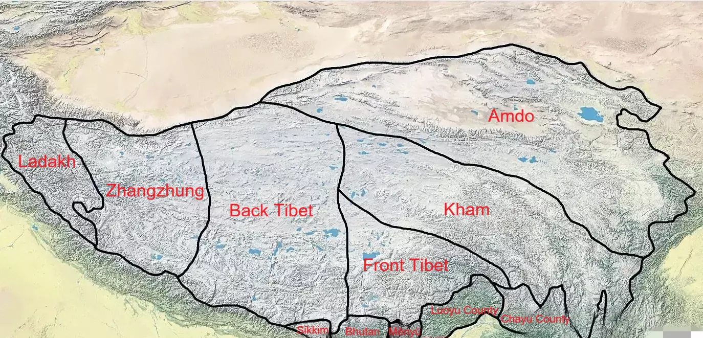
Ü-Tsang: Front Tibet and Back Tibet
- Beatrice
- Last Updated : 03/13/2026
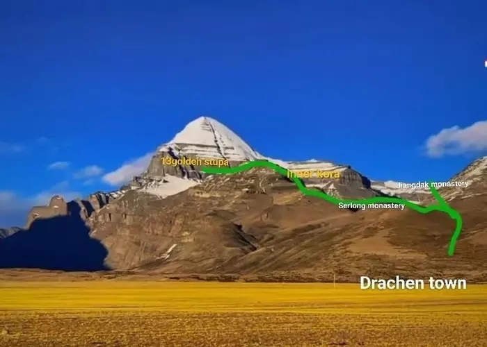
Ü-Tsang is composed of two regional concepts: “Ü” and “Tsang”. Ü refers to the area around the Lhasa River Valley, stretching east to Hengdala Mountain (ancient name) and west to Gangbala Mountain, referring to the Lhasa and Shannan, where the Tibetan Empire originated and developed, also called Front Tibet; Tsang refers to the Shigatse region, extending west of Gangbala Mountain to the Nepalese border, also called Back Tibet.
Ü-Tsang is the cradle of Tibetan civilization, serving not only as a religious and cultural center but also historically as the political and economic core of Tibet. During the Yuan and Ming Dynasties, it was called U-Tsang. During the Qing Dynasty, it was called Ü-Tsang. The Qing court authorized the Dalai Lama to govern Front Tibet and the Panchen Lama to govern Back Tibet, forming a long-standing system of religious and administrative division.
The region features diverse terrain, open valleys, mild climate, and fertile land, providing ideal conditions for agriculture and the flourishing of religious culture. Lhasa River Valley offers scenic beauty, while numerous historical relics and monasteries are important symbols of Tibetan culture.
Origin of the Name and History
The concept of Ü-Tsang is closely tied to the history of the Tibetan Empire. Before the Tang Dynasty, the Tibetan Plateau was divided into small kingdoms and tribes, known as the “Small Kingdom Period.” After the rise of the Tibetan Empire, these small states were unified, with Lhasa as the capital, and administrative divisions were established in Ü-Tsang, laying the foundation for the later concept of the region.
As a result, the Nyangchu River region, where the Zangfan lived, gradually became widely known as “Zang” (gtsang). In Tibetan, “Zang” means river, referring to the Nyangchu River (Yarlung Tsangpo River). The central area of the Tibetan Empire, around Shannan and Lhasa, was called “Wei” (adus), which means “center” in Tibetan. Together, these two regions form Ü-Tsang, which later came to be used as a general term for Front Tibet and Back Tibet.
During the Tibetan Empire, Songtsen Gampo established central governance in Ü-Tsang and implemented an administrative system to consolidate control over the plateau. These measures not only strengthened the central authority but also established Ü-Tsang as a political, cultural, and religious center. Administratively, he divided Ü-Tsang into four “ru,” roughly equivalent to modern-day provinces. The four “ru” formed the core territory of Tibet, while Dokang referred to areas outside Ü-Tsang, including most of Qinghai, eastern Tibet, western Sichuan, and Diqing in Yunnan. “Dokang” combines Amdo (a-mdo, highland plains) and Khams (khams, borderlands).
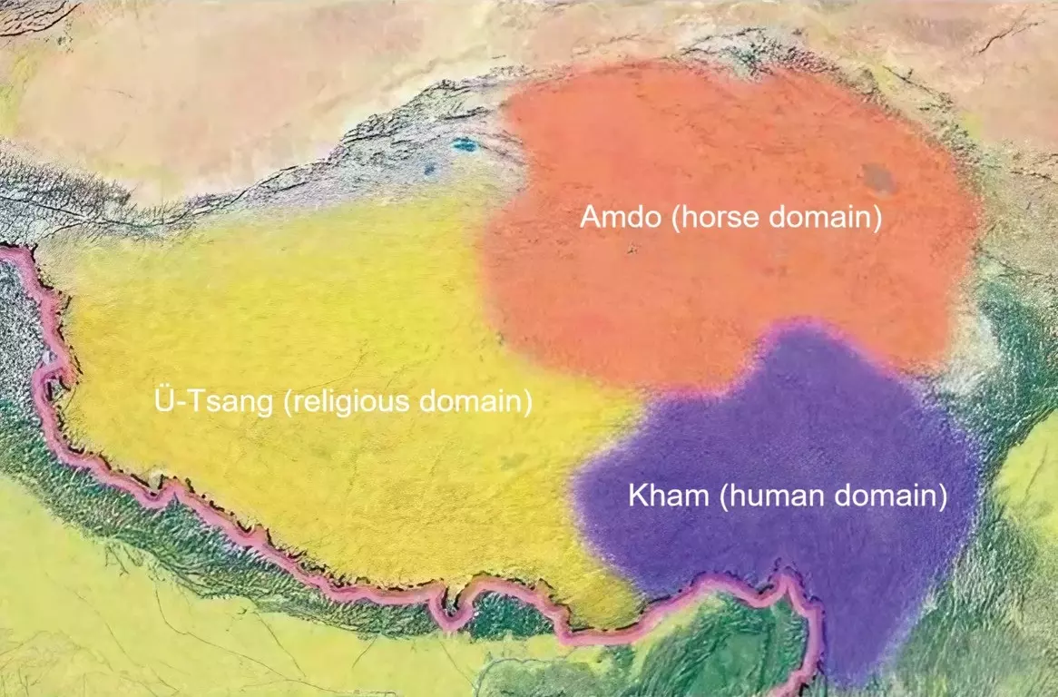
In the Song and Yuan dynasties, as Tibetan Buddhism flourished, Tibetans divided the region into three domains based on environment and customs: Ü-Tsang (religious domain), Kham (human domain), and Amdo (horse domain). A local saying goes: “Amdo has the best horses, Kham the most beautiful people, Ü-Tsang the strongest religious influence.” This division laid the foundation for the modern three major Tibetan regions.
Three Major Tibetan Regions
Tibet is traditionally divided into three regions: Ü-Tsang, Kham, and Amdo, each with distinct geography, culture, and lifestyles.
Ü-Tsang
- Geography: Lhasa, Shannan, and Shigatse; encompasses Front and Back Tibet
- Culture: Strong religious influence; birthplace of Tibetan civilization; core region of Tibetan Buddhism
- Economy & Lifestyle: Fertile farmland; frequent religious and cultural activities
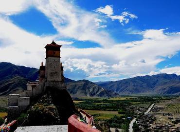
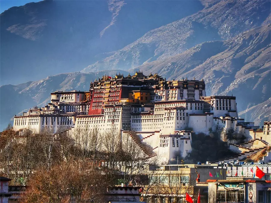
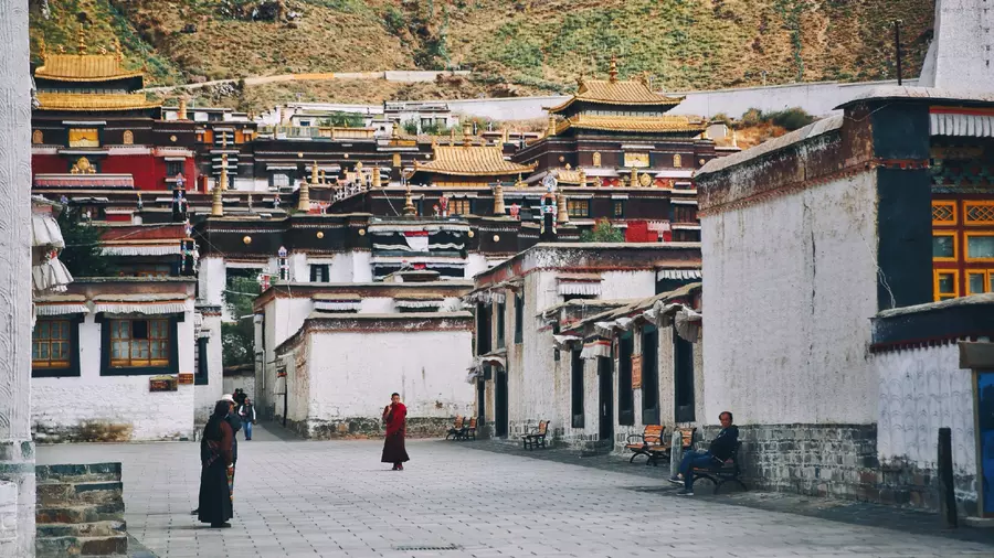
- Representative Sites: Potala Palace, Jokhang Temple, Tashilhunpo Monastery
Kham
- Geography: Southeastern Tibetan Plateau, including Chamdo, Garze, Aba, and Diqing
- Culture: Outgoing, commercial-minded, rich folk traditions
- Economy & Lifestyle: Combination of agriculture and pastoralism
- Representative Sites: Kangding, Danba Beauty Valley, Daocheng Shangri-La
Amdo
- Geography: Qinghai, southern Gansu, and areas west of the Nyenchen Tanglha Mountains
- Culture: Influenced by Mongols and Han; diverse customs
- Economy & Lifestyle: Primarily pastoral; rich in livestock
- Representative Sites: Vast grasslands, Qinghai Lake, and surrounding pastures
Each region is distinct yet complementary. Ü-Tsang forms the core of Tibetan civilization, while Kham and Amdo enrich Tibet’s cultural, economic, and natural diversity.
Differences Between Front and Back Tibet
Both Front Tibet (Ü) and Back Tibet (Tsang) were historically part of the ancient Tubo (Tibetan) Empire.
Front Tibet (Ü Region)
- Geography & History: Centered on Lhasa River Valley; political, religious, and cultural hub; Potala Palace is the Dalai Lama’s seat
- Culture & Customs: Diverse culture with strong religious influence; traditional festivals like the Shoton Festival
- Economy: Relatively developed; infrastructure well-established; tourism is an important pillar
Back Tibet (Tsang region)
- Geography & History: West of Shigatse, upper Yarlung Tsangpo and Nyangchu River basin; Tashilhunpo Monastery is the Panchen Lama’s seat
- Culture & Customs: Focus on agriculture and pastoralism; distinctive folk dances and crafts; strong religious influence
- Economy: Economic base is weaker, but agriculture, pastoralism, and tourism have great potential and have seen recent development
Conclusion
Ü-Tsang is not only a geographic concept but also a symbol of Tibetan spiritual and cultural heritage. Historical dynasties and Tibetan Buddhism have left profound marks here, and the distinct cultures of Ü-Tsang, Kham, and Amdo together showcase the rich and diverse regional characteristics of Tibet.
Email response within 0.5~24 hours.