Mount Lhotse
- Eric
- Last Updated : 05/24/2024
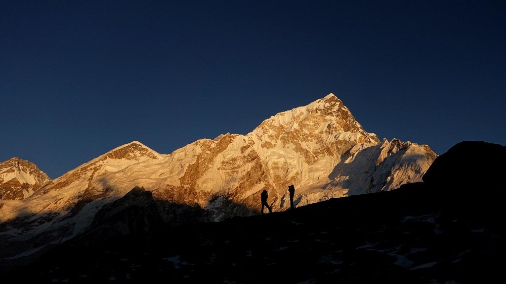
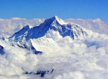
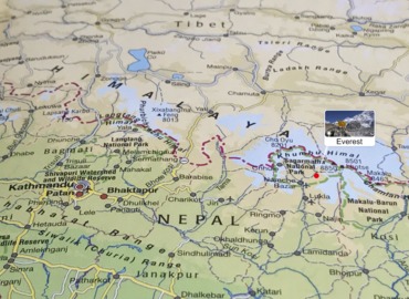
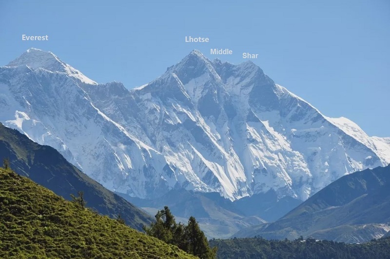
Mount Lhotse, the 4th highest peak in the world, is 8,516 meters(27, 890 ft) above sea level. Located at 27°57′42'' north latitude and 86°56′00'' east longitude, Lhotse belongs to the Himalayas. Lhotse means the "south peak" in the Tibetan because it is 3 km south of Mount Everest. Lhotse connects with Everest via "South Col".
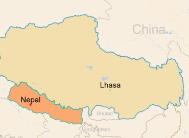
Lhotse Peak is also called "Dingjie Xie Sangma" in Tibetan, which means blue and beautiful fairy. It is bounded by the north ridge and the southeast ridge of the peak. Its east side is within the territory of China's Tibet Autonomous Region, and its west side belongs to the Kingdom of Nepal.
Features of Mount Lhotse
The mountains are majestic and steep, with frequent glaciers, ice avalanches and avalanches. Especially the base camp to the No. 1 camp is covered by thousands of years of moraine and huge glaciers. The terrain is intricate, the route is long, the ice slope is large, and there are countless huge ice cracks. The average snow depth is 60-65 cm, and the ice slope is 75 degrees, which can reach 85 degrees or more in some areas.
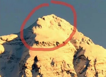
In addition to its 8,516 m (27,940 ft) main peak, Lhotse also has the following satellite peaks:
- Lhotse South, 8,426 m (27,644 ft) above sea level, is located in Nepal.
- Lhotse Middle Ⅰ, or Lhotse Middle, 8,410 meters(27,592 feet) above sea level, is located on the border between Tibet and Nepal. It was first summited by a Russian mountaineering team on May 23, 2001.
- Lhotse Middle ⅠⅠ, 8,372 m (27,467 ft) above sea level, is located in Nepal and belongs to the Himalayas.
- Lhotse Shar is located on the Tibet-Nepal border. On May 12, 1970, an Austrian mountaineering team reached the summit.
- Besides, Lhotse North Ⅰ, 8,290 m(27,198 ft) above sea level, Lhotse North Ⅱ, 8,307m(27,254 ft) above sea level, and Lhotse North Ⅲ, 8,327 m(27,320 ft) above sea level are all located in Tingri County, Tibet Autonomous Region of China.
Climate Characteristics
The topography of Mt.Lhotse is steep and dangerous due to frequent ice falls and unpredictable weather. The wind speed is slightly lower than that of Mount Everest, but the rainfall is greater than that of Mount Everest. Compared with Mount Everest, the wind speed here is slightly lower but rainfall is greater.
Every early June to mid-September each year, heavy rain and avalanches occur frequently, causing the sky covered with snow fog. From mid-November to mid-February of the following year, a strong wind coming down from the northwest makes the temperature of the mountain peak as low as -60℃. Only in the spring from the beginning of March to the end of May, or the autumn from the beginning of September to the end of October each year, the climate is relatively stable, with several periods of good weather.
Climbing History of Mount Lhotse
- On May 8, 1955, the Swiss mountaineering team reached the summit for the first time along the western slope from Nepal.
- On May 12, 1979, the Austrian team reached the summit of the satellite peak of Lhotse.
- On October 16, 1986, Italian mountaineer Reinhold Messner climbed to the top. He completed his ascent of 14 peaks of 8,000-meter.
- In 1989, one of the greatest mountaineers of the 20th century, Polish Jerzy Kukuczka directly, directly climbed to the top from the most difficult southern slope of Lhotse. But he perished during the descent. Until today, no second person in the world has ever climbed this route.
- In 1996, Chantal Mauduit became the first woman to summit Lhotse.
- In 1998, "China's Tibet Peak Expedition of 14 peaks above 8,000meters" reached the summit.
- On May 19, 2000, Italian Sergio Martini reached the summit.
- On May 23, 2001, Russians climbed the Lhotse Middle for the first time.
Climbing Routes
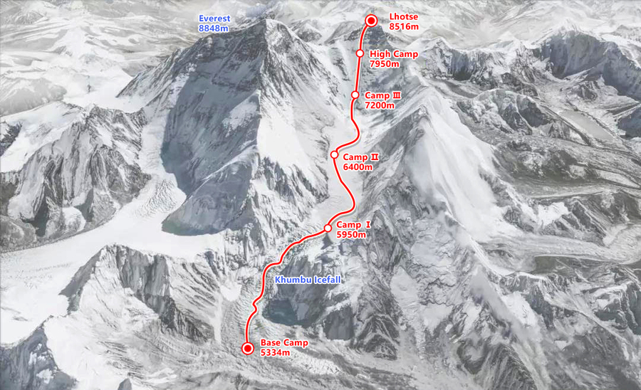
Lhotse can be viewed from a distance on the Shigatse-Everest road trip.
There is only one successful climbing route on the west slope wall of Lhotse and that was the route of the first ascent on May 18, 1956. The Swiss team led by A·Eggler first climbed the Mount Everest route to 7,800 meters, then turned to the narrow ice and snow trough route, and finally, F·Luchsinger and E·Reiss reached the summit. In addition to the traditional "Swiss Route”, there are another two routes to the summit, but both are from the south slope. Besides, there are three routes to summit the Lhotse Shar and Lhotse Middle. No one has ever topped the east slope in Tibet so far.
Email response within 0.5~24 hours.