
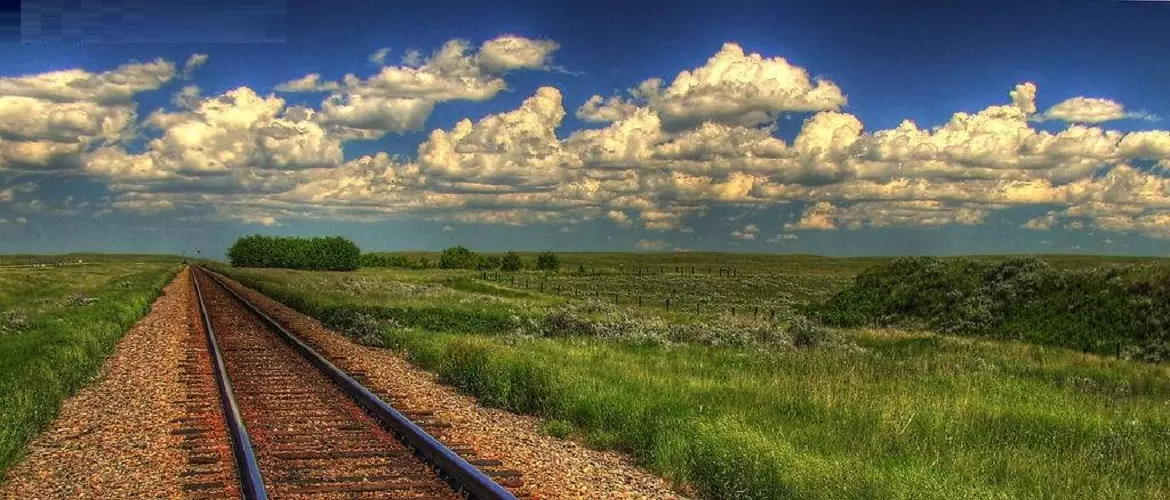
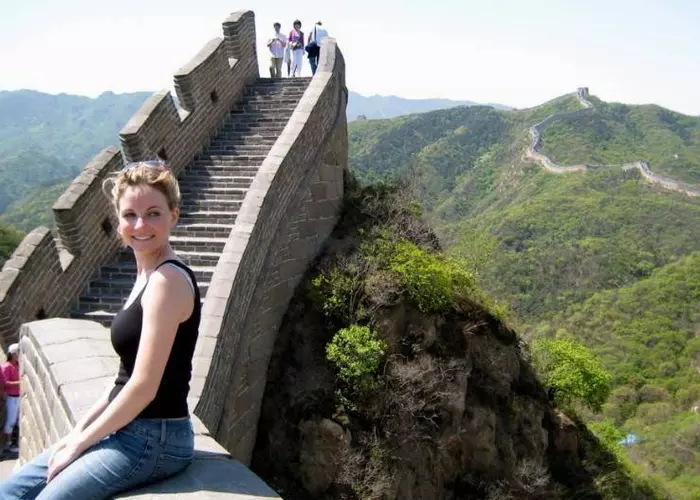
Qinghai Tibet Railway
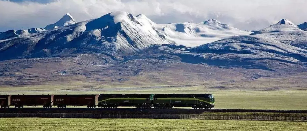
Qinghai-Tibet Railway starts from Xining - the capital of Qinghai province, to Lhasa - the capital of the Tibet Autonomous Region. It is regarded as the sky road. It was opened to traffic on July 1, 2006. There are about 550 kilometers of permafrost from Golmud to Lhasa, and it is the longest plateau railway across the permafrost regions in the world.
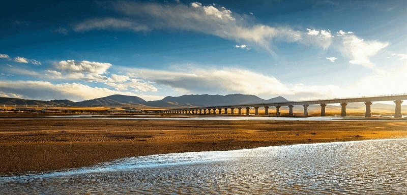
Extending 1,956 kilometers across the Qinghai-Tibet Plateau, the Qinghai-Tibet Railway is the highest and longest plateau rail line in the world after the workers and engineers overcame the challenges of the fragile ecosystem, the cold and hypoxic environment, and permafrost. The maximum speed is 160 km/h (from Xining to Golmud) and 100 km/h (from Golmud to Lhasa).
Highlights of Qinghai-Tibet Railway
Move from Xining to the west, along Qinghai Lake, pass Delingha to Golmud in the Qaidam Basin, climb the Kunlun mountains, cross the Kekexili, climb the world's highest railway station- Tangula station (5,068 meters), and enter Tibetan areas, from Amdo, Nagqu, Damxung, all the way to Lhasa.
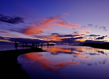
Qinghai Lake - 2,260m
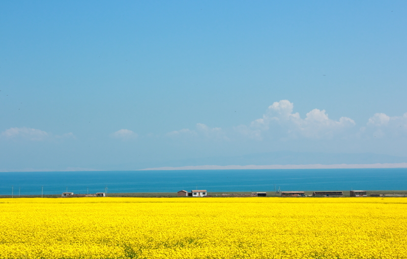
When the train departs from Xining, at an altitude of 2,260 meters, the higher the altitude, the less vegetation and population. After traveling for 150 kilometers, for about one hour, you can see the vast Qinghai Lake(3,200 meters above sea level) with an area of 4,500 square kilometers. This is the largest saltwater lake in China. Mainly Tibetan and Mongolian nomads live around the lake. The train runs along the north bank of Qinghai Lake for about half an hour. Qinghai Lake is surrounded by fields with golden rape flowers every summer.
Delingha - 2,980m
About two hours later, you will reach Delingha Station. Before the station, you first pass a high plateau, Lake Gahai. Ga is a dialect of Qinghai, which means small. Gaihai is the largest freshwater lake in the Gannan zone, Qinghai. Also, it's a bird sanctuary.
After Gaihai Lake, you will arrive at Delingha station. And then continue to a big Koruk Lake with salty water and a small Tosu Lake with freshwater in half an hour. They are connected together, so they are also called Lover Lake. This is the habitat of many birds, and the train passes between the two lakes.
Guanjiaoshan Tunnel - 3,690m
Then it will pass through the Guanjiaoshan Tunnel, at an altitude of 3,690 meters. It is the tunnel with the highest altitude in the section between Xining and Golmud of the Qinghai-Tibet Railway.
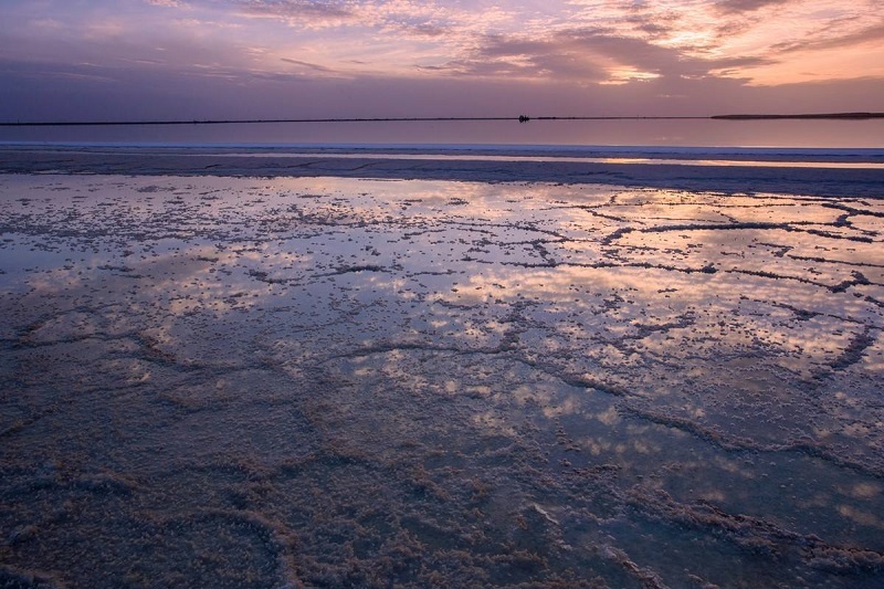
Qarhan Salt Lake - 2,670m
Located in the southern Qaidam Basin, across Golmud City and Haixi Mongolian Tibetan Autonomous Prefecture, Qarhan Salt Lake is one of the largest inland salt lakes in the world, covering an area of 5,848 square kilometers. It is the largest potash-magnesium salt deposit in China. The train passes through the white Qarhan Salt Bridge, which is made of crystals of various salts, as hard as the general asphalt road, with a total length of 32 kilometers. So this is the most spectacular sight on the Qinghai-Tibet Railway.
Golmud- 2,800m
Golmud City is 60 km to the southeast of Qarhan Lake. At an altitude of more than 2,800 meters, it is the second-largest city in Qinghai Province. Golmud is a city in the Gobi Desert in the Qaidam Basin. It is known as China's Salt Lake City because of Qarhan Salt Lake.
The Kunlun Mountains - above 5,500m
The Nanshankou Railway Station is 30 kilometers away from Golmud, and then continuing to the south, you can see the tall Kunlun Mountains. The highest peak is Yuzhu Peak at 6,178 meters above sea level, with glaciers and snow all year round, even in the hot summer. The Qinghai-Tibet Railway passes by the foot of Kunlun Mountain.
Hoh Xil Nature Reserve - 4,600m
Looking to the southwest direction from the Kunlun Mountain Pass, you can see the Hoh Xil uninhabited area at an average altitude of 4,600 meters. The terrain is steep and the climate is harsh, with an area of 45,000 square kilometers. This is the largest unmanned area in China and the third-largest in the world. It is located in the Qinghai Yushu Tibetan Autonomous Region, spanning three provinces - Qinghai, Xinjiang, and Tibet. It's a happy paradise for wild animals such as antelopes, wild yaks, wild Tibetan donkeys, etc. There are 230 unique kinds of wild animals on the Qinghai-Tibet Plateau.
The Natural Landscape of the Source of the Yangtze River
After crossing the Kekexili uninhabited area, you will reach the landscape zone of the Yangtze River source, which is the headstream of the Yangtze River, the Yellow River, and the Lancang River. It originates from the main peak of Tangala Mountain, with very peculiar glacial landforms.
Tuotuo River -- 4,547m
Tuotuo River is one of the sources of the Yangtze River, the longest river in China. After the iceberg melts, it forms the Jinsha River after passing through the Tuotuo River Basin and finally flows into the rolling Yangtze River after passing through Sichuan, Yunnan and other places. When the train passes through the Tuotuo River, you will be shocked by the magnificence of the source of the Yangtze River. If you are lucky, you can also see the sunrise on the River on the train.
Tangula Railway Station- 5,068m
Tanggula Mountain is located at the junction of China's Qinghai Province and the Tibet Autonomous Region. It is known as "the closest place to heaven" because there is the world's highest railway station - Tangula Railway Station, at an altitude of 5,068 meters. The oxygen content drops a lot and you can feel a sense of altitude. The Tanggula Mountain section is the most difficult part of the construction of the Qinghai-Tibet Railway.
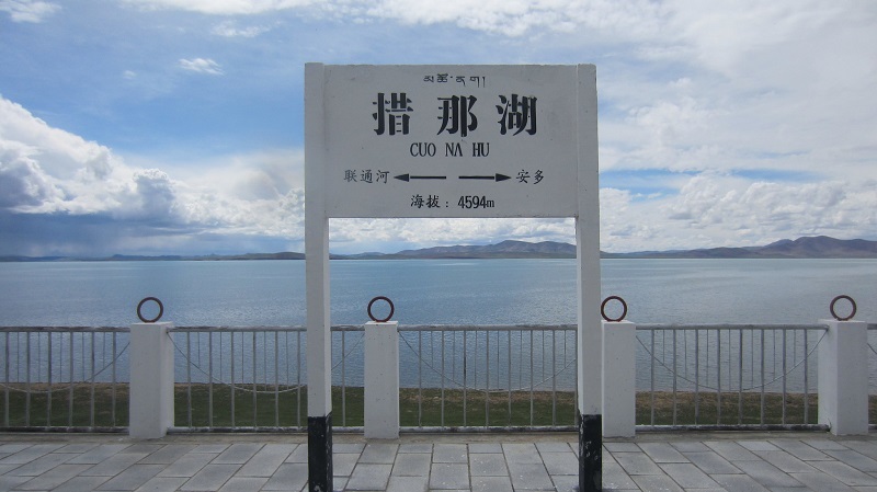
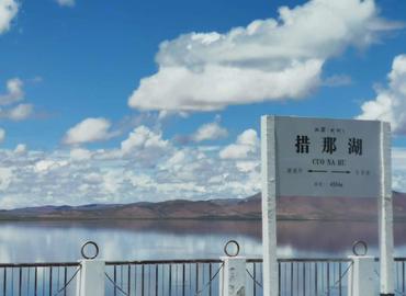
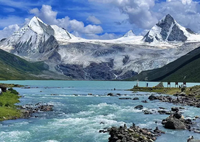
Cona Lake - 4,594m
Cona Lake is also called Tsonag Lake. After crossing Tanggula Mountain, it entered the Tibetan territory and continued to Cona Lake in Amdo County, Nagchu, Tibet. Cona Lake is the largest freshwater plateau lake on the Qinghai-Tibet Plateau with an area of about 400 square kilometers. You can see a lot of Rare wild animals here. Like Namtso Lake, Cona Lake is where pilgrims often come to worship. Legend says it was a bathing place for the Queen Mother of the West. The local Tibetans regard Cona Lake as a "sacred lake".
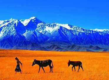
Qiangtang Prairie - 4,293m
The Qiangtang Prairie is a grassland on the Northern Tibetan plateau in Nagqu, with an elevation of 4,293 meters, and an area of more than 600,000 square kilometers. It is the largest pure natural grassland in Tibet! It is the home of wild black yaks, wild Tibetan donkeys, Tibetan antelopes, and so on. If it is in July and August, you will be able to see the most famous horse race in Tibet. Tibetans from the entire Qiangtang grassland will come here, and the celebration dance will last for more than half a month.
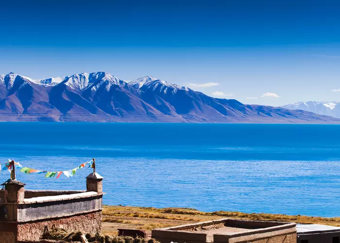
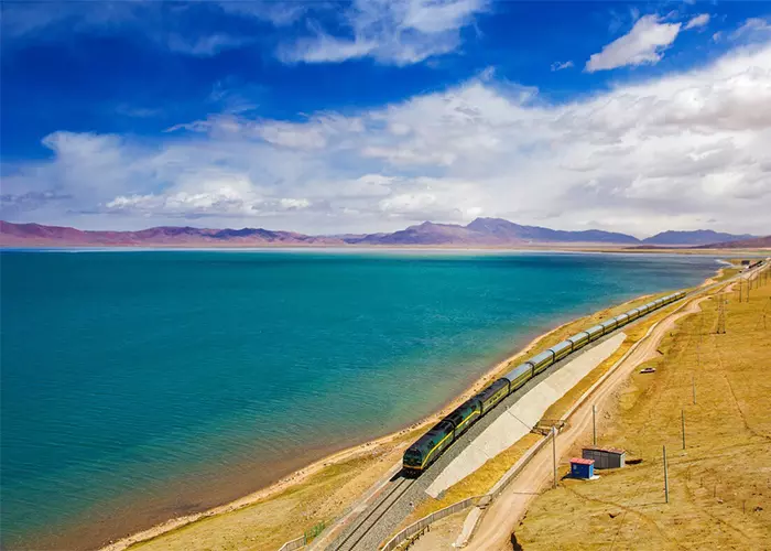
Lake Namtso - 4,718m
About three-fifths of Lake Namtso is in Nagqu and two-fifths in Damxung County of Lhasa. It is the second-largest lake in Tibet and the third-largest saltwater lake in China. The lake is 4,718 meters above sea level, making it the highest large lake in the world. Namtso means "heavenly Lake" in Tibetan.
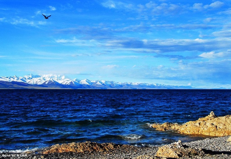
Nyenchen Tanglha Mountains - above 5,000m
The southern shore of Lake Namtso is the Nyenchen Tanglha Mountains(also called Nyannchenthanglha Mountains). It is one of the three sacred mountains in Tibet (Gangdise, Nyenchen Tanglha and Maji Snow Mountains). It is one of the sacred mountains of the oldest Tibetan Bön religion, with a total length of 1,400 kilometers, an average width of 80 kilometers, and an altitude of 5,000-6,000 meters. Nyenchen Tanglha Mountains are the largest glacial area in the southeast of the Tibetan Plateau. The main peak, Nyainqentanglha Peak, is 7,111 meters above sea level and is covered with snow all year round.
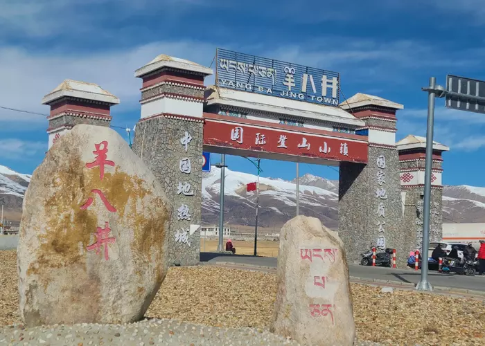
Yangpachen - 4,231m
The train goes to the southeast, and you will reach Yangpachen town. Located on the grassland in northern Tibet, it is 4,231 meters above sea level. It is rich in geothermal resources, with the largest number of hot springs. The water temperature is the highest among Chinese hot springs, up to 93℃~172℃. You can soak in the hot springs to enjoy the snow-covered Nyenchen Tanglha Mountains. Yangpachen Geothermal Power Plant, the first geothermal power station in China, was built in 1976.
>>See more about Yangpachen Hot Springs
Lhasa River - 3,600m
The last landmark before arriving at the Lhasa Railway Station is the Lhasa River. It originates in the Nyannchenthanglha Mountains and passes through Lhasa, where it flows into the Yarlung Zangbo River. With a total length of 568 kilometers, the Lhasa River is one of the five major tributaries of the Yarlung Zangbo River. It is one of the highest rivers in the world. The soil along the river is of good quality and is one of the main grain-producing areas in Tibet.
Lhasa Railway Station - 3,600m
After crossing the Lhasa River Bridge, the Qinghai-Tibet train enters from the northwest suburb of Lhasa. A wide range of urban landscapes comes into view. The most prominent one is the magnificent white and red building, the Potala Palace. Then it will stop at the Lhasa Railway Station in the south of Lhasa.

Chengdu-Xining-Lhasa
Get close to Giant pandas. Hop on the Sky Train from Xining to enjoy alpine scenery. Explore Tibetan Buddhism in Lhasa.
Beijing-Chengdu-Emei-Chengdu-Lhasa
Visit Beijing's essences as well as the highlights of Chengdu and Lhasa to discover the culture and traditional beauty.

Guangzhou - Lhasa
Take you from Guangzhou to Lhasa by train, showing Qinghai-Tibet railway, as well as the different cultures and nature.
Email response within 0.5~24 hours.
Typically Asked Questions from Our Clients
LEE ***
Hello,
We are a family of 4 planning a private 4-night 5-day tour in Lhasa, departing after April 17(18 or 22 or 24), and would like to include Tibet Travel Permits. We have several questions before booking:
1. Three of us plan to enter Tibet via the Qinghai-Tibet Railway (Train), and one person needs to enter by flight due to schedule constraints. Is this possible for a single tour group?
2. If we take the Qinghai-Tibet Railway, will the train tickets be booked by your agency, or do we need to book them ourselves?
3. When applying for Tibet Travel Permits, is a passport required, and what is the application process?
Dear Lee****,
We can arrange the 5D4N Tibet tour on April 17th for you.
1. Yes, you can board the train/flight to Lhasa separately. May I know if it's the same city?
2. For the train ticket, we can help you book or you can book on your own.
We usually entrust ticket booking to professional scalpers because they can secure 4 soft sleeper tickets in one cabin. However, they will charge the service fee.
3. Yes, we need your passport copy to apply for the Tibet Travel Permit. If you all hold the South Korean passport, you can enjoy 30-day China Visa free policy, and we just need your passport.