Gangkhar Puensum
- Catherine
- Last Updated : 07/15/2024
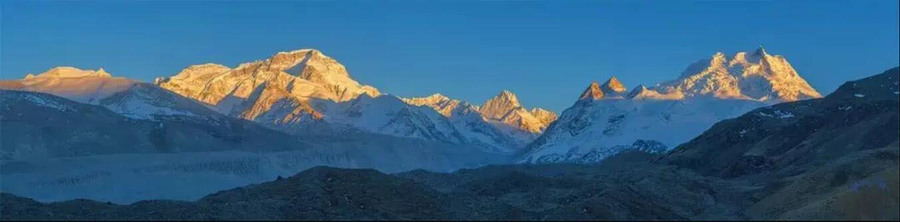
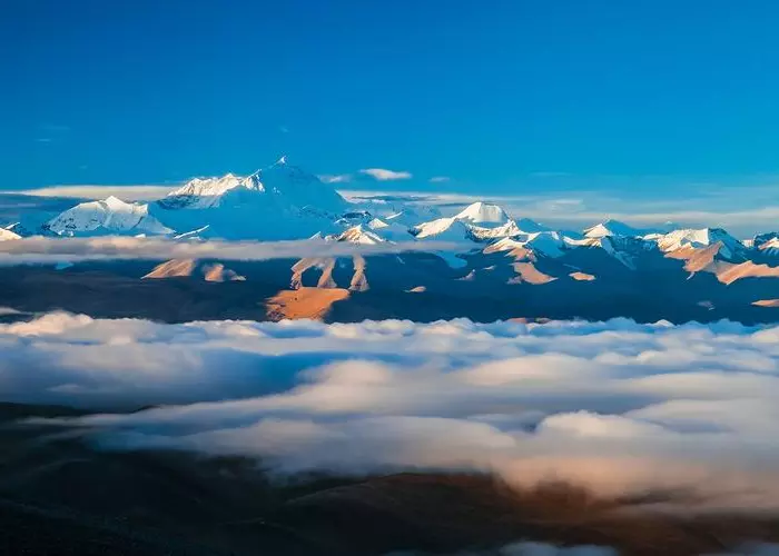
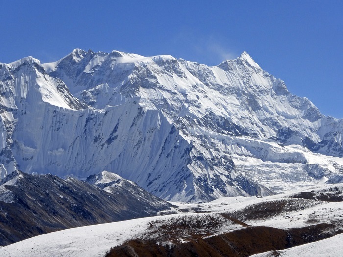
Gangkhar Puensum, also known as Kanchenjunga, is 7570 meters above sea level and the 40th highest mountain in the world. It is located in the border area between China and Bhutan. It is currently the highest unclimbed mountain in the world although it's 1,274 meters lower than Mount Everest. The name of the mountain can roughly be translated as "White Peak of the Three Spiritual Brothers". This may explain why the Bhutanese authorities announced the ban on climbing this mountain in 1994, out of respect for the local spiritual beliefs.
Gangkhar Puensum is located at the controversial border between Bhutan and China, but what's certain is that Gangkhar Puensum is the tallest unclimbed mountain in the world.
With the development of human history, there are many mountains that have been conquered. Even the 8,844-meter-high Mount Everest, there are new conquerors every year. However, although Mount Gangkhar Puensum is 7,570 meters high, which is 1274 meters lower than Mount Everest’s 8,844 meters (Chinese standard), no one has been able to reach its summit so far. Expeditions from many countries have been tried many times, but all ended in failure. There are actually two reasons,
On the one hand, the Gangkhar Puensum mountain is indeed very difficult to climb. The terrain here is very complicated. Many explorers come here without knowing where to go up the mountain. There was no map here long ago. Many people can only try to find the entrance with experience and intuition, but all fail. Later, a scientist made a map of the local area through field surveys, which made people know something about the mountain. Although it was allowed to open in 1983, the four climbing attempts finally failed.
On the other hand, the law banned climbing it. Since 1994, the Bhutanese government has stipulated that all peaks above 6,000 meters above sea level in Bhutan are prohibited from climbing to show respect for the spiritual beliefs of local residents.
In the hearts of Bhutanese, sacred mountains are inhabited by gods and cannot be disturbed by humans. The name of Mount Gangkhar Puensum can be roughly translated as "White Peak of the Three Spiritual Brothers", which is a well-deserved sacred mountain. Bhutanese hope that in this life, this mountain will not be trampled on by human footsteps. However, there was no strict ban at that time. It was completely banned in 2003. Now, no one can go climbing this mountain officially.
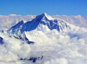
Nevertheless, some people still tried to observe Gangkhar Puensum by climbing another peak close to its summit. At the end of the 20th century, a group of Japanese explorers ever climbed a peak next to its summit for close observation. In 1998, an expedition from Japan approached to climb the peak from the north side and obtained a permit from the Chinese Mountaineering Association, but the permit was withdrawn due to a political issue caused by Bhutan. In 1999, the mountaineering team set off from Tibet, China, and successfully ascended the northern second peak of Gangkhar Puensum (also known as Gangkhar Puensum North), which is at an altitude of 7,534 meters. This can be said to be the closest climb to the Gangkhar Puensum summit.
For some ordinary tourists, traveling to Bhutan is also very difficult, because the Bhutan government does not accept self-guided tours and tourists can only participate in a tour with a group, and the consumption here is also very high, with a minimum daily consumption of $200, which seems a bit exaggerated.
Even if you can travel to this country, you would not be able to easily approach the Gangkhar Puensum Mountain. You must start from Punakha in the direction of Gasa and walk from Gasa to the hardest place to reach Bhutan - Lunana for 8 days to the Gangkhar Puensum Camp. Not to mention the tourists, even for the locals, it is a great test. It is really difficult to see the number one mountain in Bhutan up close. Therefore, the second-highest peak, Jomolhari, which is easier to see, has become more famous.
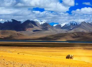
What if you travel from the side of Tibet, China? The area is located in Lang Musangpu Lhozhag County, Shannan, it is almost the wilderness, and there are no facilities around, so getting there is also an arduous task. Compared to the approach from the side of Bhutan, getting to Gangkhar Puensum from the Tibet side would be more difficult. So this formidable mountain can be called a virgin peak from the perspective of climbing or viewing.
Email response within 0.5~24 hours.